


Introduction
I'm glad you've found this page because I'd like to give you all my tips to make your hiking holiday an unforgettable
experience. I've been hiking in Tenerife regularly since 2014. Even on my first visit I was very impressed by the diversity of the Anaga
and Teno mountains and the Teide National Park. Over the past 10 years I have walked 91 different hikes, filmed a major documentary and
written a Hiking Guide Tenerife in 3 languages. You can also hike
my tours using the descriptions on this page.
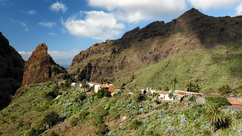
Image gallery of Tenerife
Hiking areas, Titsa buses, hire cars
Tenerife has the rather rugged Teno Mountains in the north-west, the green Anaga in the north-east, the centrally located Teide National
Park and smaller hiking areas in the south. For a hiking holiday, I recommend a hotel in the north, 2 excursions each in Teno and Anaga,
some in the national park and, in bad weather, 1 or 2 in the south. You can also hike in the morning and relax by the pool or the sea in the
afternoon. But beware: at midday the north-east trade winds pick up and can bring clouds to the north.
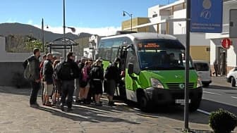
The TITSA bus network is well developed and largely allows you to do without a hire car. Connections are usually associated with longer
waiting times. Some tours, e.g. in Anaga, simply cannot be organised because there is only one bus in the morning and one back in the
evening.
You are much more flexible with a hire car. There are many providers directly at the airport, in larger cities and hotels. You should book your hire car at home. I have made very good experiences with Autoreisen. No additional insurance is required as the car is fully insured. Only problems with tyres and underbody supposedly cost extra. But in the past, Autoreisen has proven to be very gracious. So far, all damage has been covered and, if necessary, I have had a new car delivered to the hotel or been able to pick it up at the Aeroporto Norte.

The most beautiful hikes for beginners and advanced hikers
When hiking in Tenerife, beginners should first orientate themselves on the blue hikes. I also recommend changing the hiking areas. If you live in the north, you won't hike so often in the south. But in a 14-day hiking holiday, you can go to Anaga twice or to the south once. This often depends on the weather, because when it rains in the north, you often have sunshine in the Teide National Park. Here are my tour recommendations for beginners and newcomers to Tenerife.
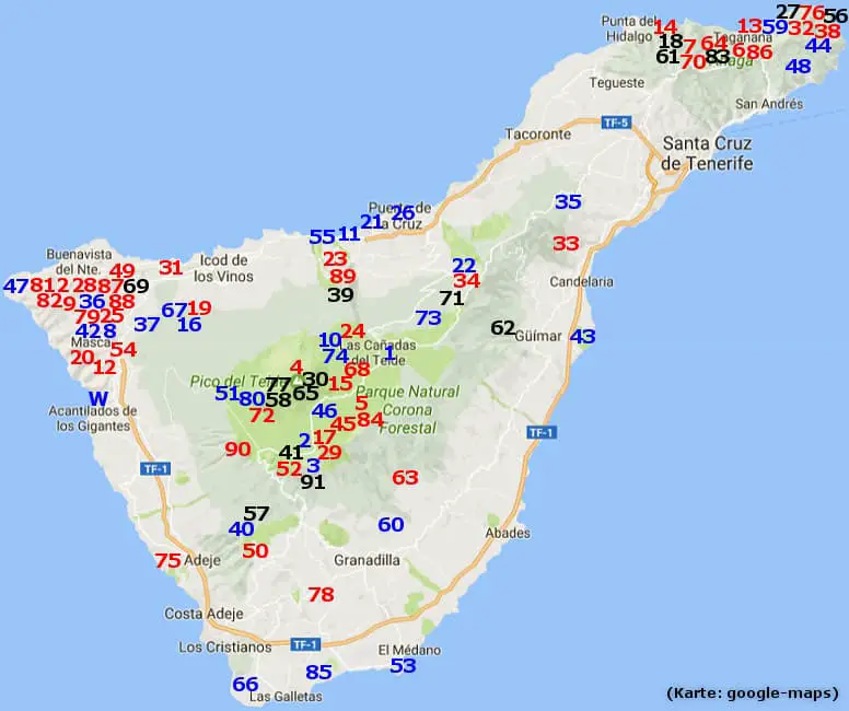
11 16 22 36 42 19 54 19 54
Teno/North:
44 48 59 38
Anaga:
1 2 10 80 15 17 24 72
Teide National Park:
40 53 66 85 75
South:
For example, you can decide whether to take the easy or medium-difficulty tour to Fortaleza in the national park. The 17 (Guajara) or
the 72 (Narices del Teide) should be seen as the highlight and maximum for beginners. I would advise beginners against the Barranco Masca
as long as the boat landing stage has not yet been renovated, because the ascent in the second part is very strenuous.
For advanced hikers with hiking experience, the above tours are ideal as a warm-up or for an intermediate day. The following
recommendations are more demanding.
20 28 33 34 49 89 62
Teno/North:
6 7 32 70 86 18 56 83
Anaga:
29 90 58 65
Teide National Park:
50 63 57
South:
All hikes not mentioned are of course also beautiful. Please only do the following hikes if you have alpine experience and are in good physical condition.
69
Teno/North:
30 41 77
Teide National Park:
Closed hiking trails
Closed hiking trails are not uncommon on Tenerife. These closures should be taken seriously, as the weather can cause rockslides, falling
rocks and other obstructions. The island administration endeavours to remove closures as quickly as possible. In any case, hikers always walk
at their own risk.
12 47
Teno:
27 56 6 13 76
Anaga:
57
South:
Access to the Guerguessteig has been blocked by the owner of Finca Casas de Araza since 2018. As he is the owner of parts of the ridge,
the closure appears to be legal. Entering the barrier is not recommended.
In the area from Faro de Anaga to El Draguillo there are several rockfalls and an increased risk of falling rocks. The closures are to be
taken seriously in any case. An ascent is strongly advised against.
The main hiking trail between Afur and Playa de Tamadite is closed due to a rock slide. There is a diversion.
The hiking trail at Playa de los Roques in Puerto de la Cruz is closed due to the risk of falling rocks. However, access is possible. In
the area around the Maritim Hotel, the path is often obstructed by construction work. Please note the current closures.
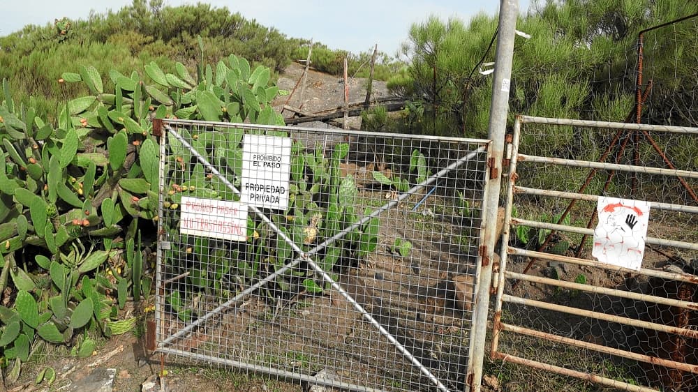
Image gallery of closed hiking trails
The most beautiful barrancos
The most famous gorge is the Barranco de Masca. However it can only be hiked down and up again with a registration. But there are many alternatives on Tenerife. The second best known is the Barranco del Infierno. It is now secured against falling rocks and costs € 9 to enter. You walk along a paved path in the midst of beautiful nature. Despite the restriction to 300 people per day it is quite crowded.
open
Barranco de Masca:
open
Barranco del Infierno:
open
Barranco de Ruiz/La Vera:
close
Barranco de Ruiz/Icod:
In the Anaga Mountains I recommend the Barranco Bermejo near Chamorga. You should first descend the barranco and then climb up to the Casas Tafada. This way you can enjoy the barranco and walk the ascent partly in the shade. The Barranco de Igueste is above Teresitas Beach. The tour is very short, so you can spend the afternoon on the beach. The tour from Taganana via Afur and the Barranco de Tamadite is quite demanding but a real experience.
To the north you can climb directly into the Barranco de Ruiz from the car park on the TF-5. Because of the increased danger of falling rocks this is currently closed. The way back is then directly along the Atlantic Ocean. From Los Silos you can climb up to Erjos and then look down into the Barranco de los Cochinos on the way down. From January to March during the almond blossom we recommend the Barranco de Santiago near Tamaimo..
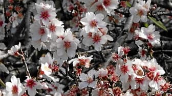
Almond blossom at Tamaimo.
The right routing
To enjoy a hiking holiday you need the right route. Generally I try to plan the tours in such a way that I generally try to plan the tours in such a way that the ascent takes place first followed by a recovery phase and then the flat descent. The ascent is easy on the joints are spared but you need to be in good shape. After a recovery phase the descent takes place with the load on the joints. If you were to start the descent now the joints would already be under too much strain during the final ascent. Of course it is not always possible to keep to this schedule. But especially on difficult tours this approach can reduce the load on the joints. In my opinion hiking poles should also be used for medium and difficult hikes. Here you can distribute the forces on the ascent and cushion them on the descent.
Hiking at over 3000 metres
If you want to hike at an altitude of over 3000 metres it makes sense to get used to the altitude slowly. You should start with
a hike in the Canadas at an altitude of 2000 metres, then increase to 2700 metres (Gujara, Montana Blanca) and only then hike to the Teide
or Pico Viejo. Taking a day's break or a hike in the Anaga/Teno between the first 2000-metre hikes can't hurt either. You are less
susceptible to altitude sickness and also more efficient.
climatic conditions
In terms of climate you can hike on Tenerife all year round. July to September are the hottest months and from November to February you can expect 5-7 rainy days a month. If you live in the north you should go to the Teide National Park when it rains. There the sun often shines above the cloud line. Exceptions are storms that affect the entire island. The next day access to the national park is often blocked because of fallen trees. After 24 hours the roads are usually clear again.

Such masses of snow as in February 2016 are rather rare. However in the Canadas at 2000 metres above sea level and on the Teide snow regularly falls in the winter months. The main hiking trails are then closed.
For a trip to Teide National Park, check a webcam located in the Canadas in the morning. For example the following link:
Permits in the Anaga Mountains
Besides the summit climb of the Teide where you need a permit there are also 4 areas in the Anaga Mountains there are also 4 areas where this applies:
- Reserva Natural Integral Roques de Anaga
- Reserva Natural Integral de Ijuana
- Reserva Natural Integral del Pijaral
The first two areas are not accessible or are very difficult to access. For the del Pijaral area, there is the possibility of an online permit on this site. It is free of charge and only valid for one day. You should check the weather forecast a few days in advance and then book. It is enough to have the permit email with you on your smartphone.
Teleferico
There are a few hikes on Tenerife where you need to take the up or down the Teide with the Teleferico. First thing in the morning you should go to the official website see if the mountain railway is running. Often the status on the page only changes around noon. Sometimes, for example after storms you have to check the status via a chat window. By the way the weather information is very rarely updated.
On weekends or public holidays it may be useful to purchase a ticket for a specific time on the website. However, internet bookers
also have to wait on site. The check-in on days with high demand is not exactly optimal. The staff are eager but often give the wrong
information.
GPS tracks and tracking app
If you are travelling on your own you need the GPS tracks and an offline-capable app because in the high mountains a mobile network is not available. I hiked all the tracks myself. They are part of my Hiking Guide. The corresponding web app also offers offline-capable GPS tracking. As an additional GPS app with even more functions I recommend OsmAnd with the map of the Canary Islands.
The most beautiful videos from Tenerife
On my Youtube-Channel you can see many videos from Tenerife. Among other things a 10-part documentation of the most beautiful hikes.