


![]()
Difficulty: easy
Fitness: easy
Fear of heights: easy
Surefootedness: middle
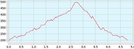
Distance: 4,79 km
Duration: 2:40 h
Höhen: ![]()
![]() 292
292
Start/End:
Igueste de San Andres

Hike 48: Barranco de Igueste
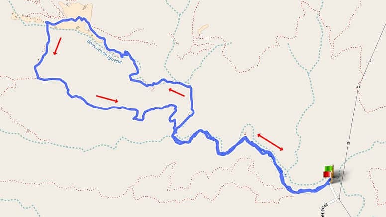
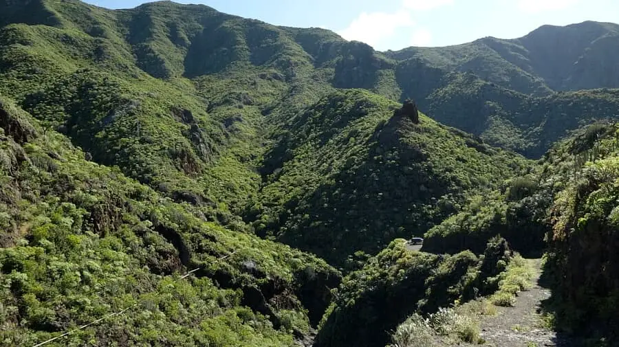
Above the most beautiful beach of Tenerife, Playa de las Teresitas, the foothills of the Anaga Mountains begin. The hike leads into one of the most beautiful barrancos of Tenerife. Even the approach is somewhat adventurous. Before reaching Playa de las Teresitas, we drive up the mountain on the left and enjoy the best view of the beach at the Mirador. This should be done on the outward journey to enjoy the Teide above everything. The drive continues over serpentines to Igueste de San Andres. The road becomes quite narrow and at a bend we have to turn left into a dead end. This road is then so narrow that in case of oncoming traffic, we have to agree on who is allowed to drive. We drive uphill at 30 km/h. Here, water sometimes flows over the road, an indication of the approaching barranco. At the end of the asphalting, the road ends and we park the car.
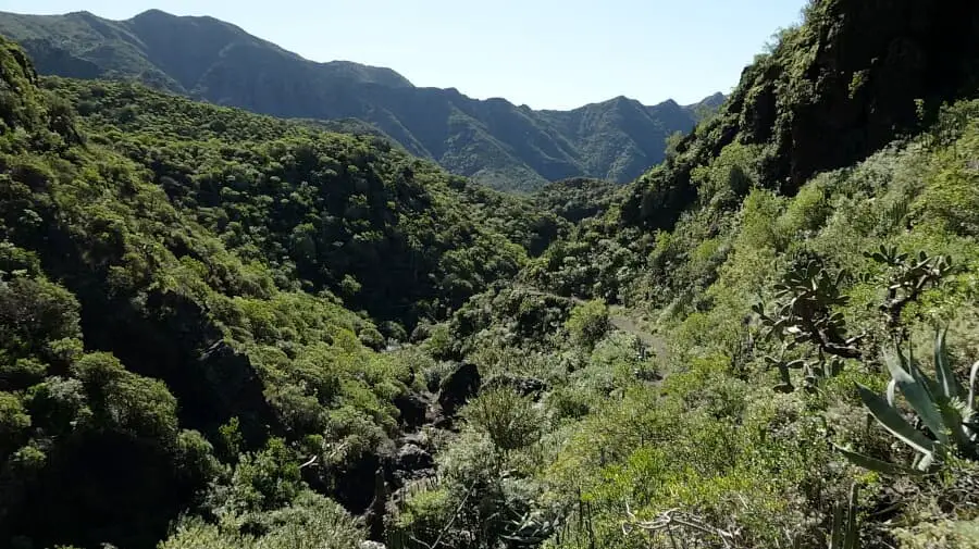
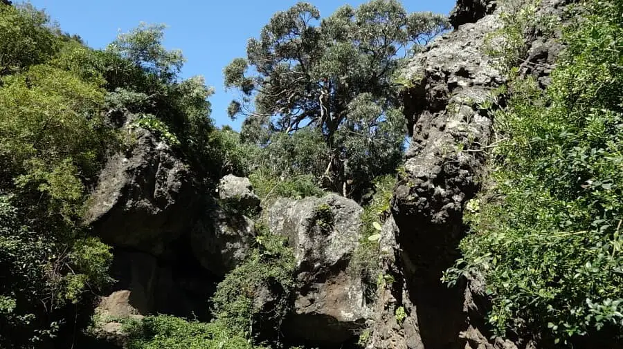
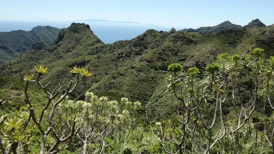
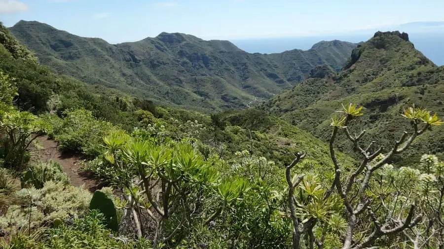
Here a sign informs us that the area is private property, like 90% of the Anaga Mountains. We take the main hiking trail and after a short time we find ourselves in the middle of a fantastic barranco. The untouched nature in lush green, the rushing watercourse and the singing birds far away from civilisation leave a deep impression. The path is a bit bumpy in places, typical for a barranco. We pass water points where it is worthwhile to linger. We stay on the slightly ascending main path until we reach a small settlement. There are a few houses here but no roads or cars far and wide. At the end of the settlement the path splits. Straight ahead we go up to the Anaga ridge. We turn left, passing a small house with a garden.
This path leads up to a ridge, which we reach after 15 minutes. Up here we have views of 3 different valleys. We take the path to the left, which leads us in a steady descent back down to the barranco. The last part of the hike is back on the way there, in the middle of the barranco. If you plan the tour during the week, you will not disturb any private owners. After the tour, you should definitely plan a detour to Playa de las Teresitas. The fine Sahara sand was heaped up in the 70s.
A detailed description of the route and the GPS track can be found in the Hiking Guide Tenerife.
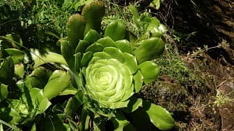
The rosette of the plate-shaped aeonium, one of the thick-leaved plants of Tenerife.
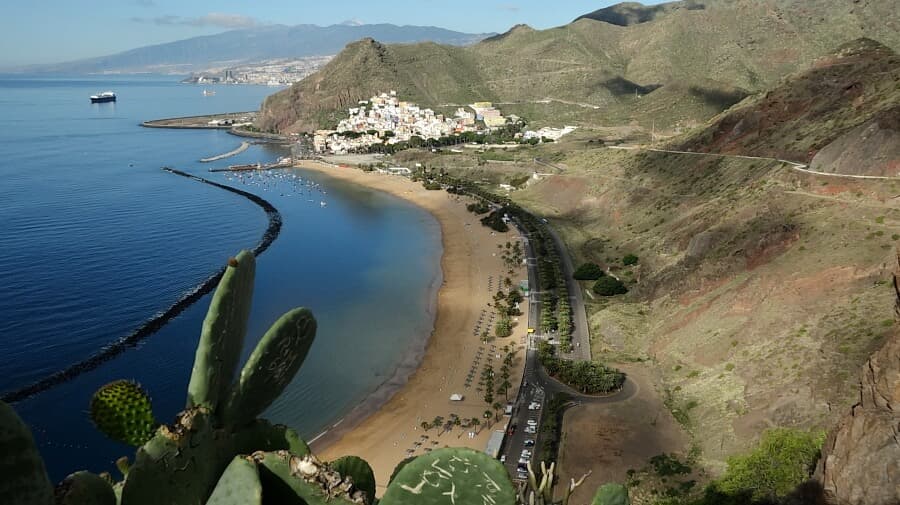
Photo Gallery
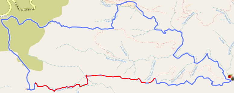
Alternative: You can still climb up to the Anaga ridge (La Cancelilla). The path is easy and offers beautiful cloud forest. The descent from the ridge to the mirador is still passable. After that it becomes dangerous. A path is not recognisable as it is overgrown with bushes. There is a high risk of falling on the steep slope. I can only strongly advise against taking the path marked in red.