


![]()
Difficulty: high
Fitness: middle
Fear of heights: middle
Surefootedness: high
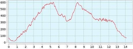
Distance: 14,00 km
Duration: 6:20 h
Heights: ![]()
![]() 910
910
Start/End:
Punta Hidalgo
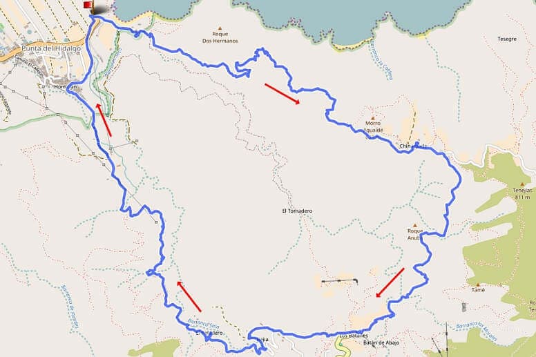

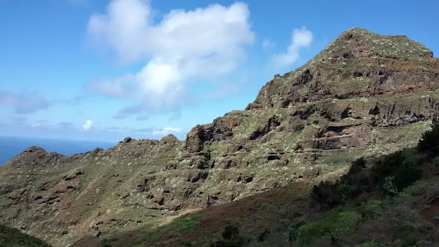
Hike 18: Punta Hidalgo/Chinamada/Bejia
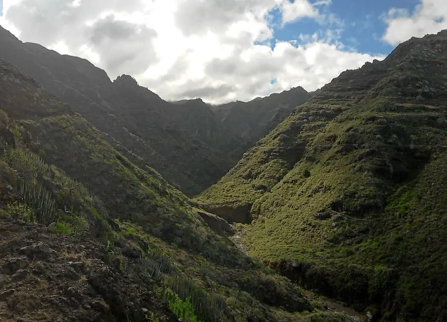
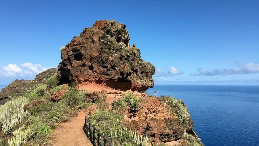
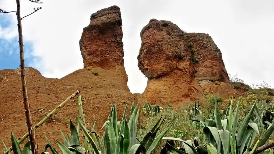
This grandiose circular tour is an own creation and one of the most beautiful hikes in the Anaga Mountains. The first part leads from Punta del Hidalgo to Chinamada (see tour 14). On the ascent, 600 metres of altitude have to be taken. We walked the route in 2:15 h. A hort rest in Chinamada can't hurt. The restaurant offers solid food at reasonable prices (closed on Monday and Tuesday).
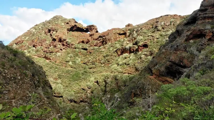
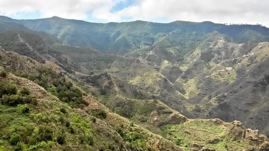
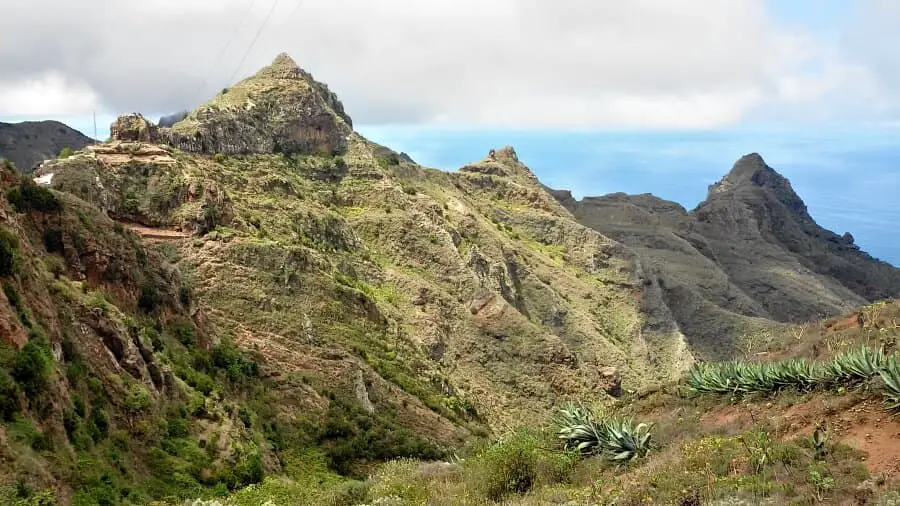
The second section leads from Chinamada down to the Barranco del Rio (see Tour 7). The path is relatively easy, but quite steep in parts and after 20 minutes you have to overcome steps cut into the rock at an airy spot. When you reach the Barranco del Rio, the trail leads 300 metres to the left of the barranco. After crossing the Barranco, we keep to the right in the direction of Los Batanes. From Chinamada, the section takes just under 1:45 h.
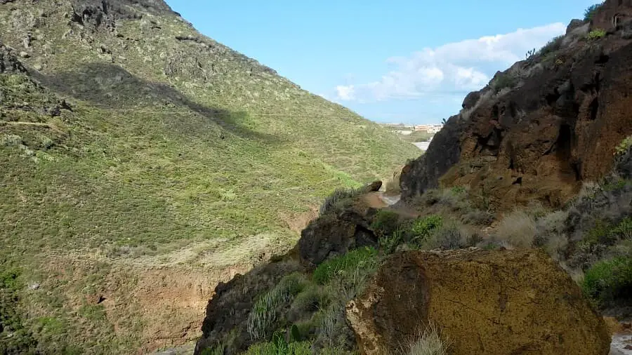
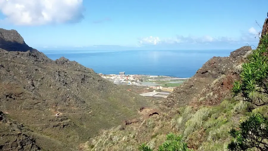
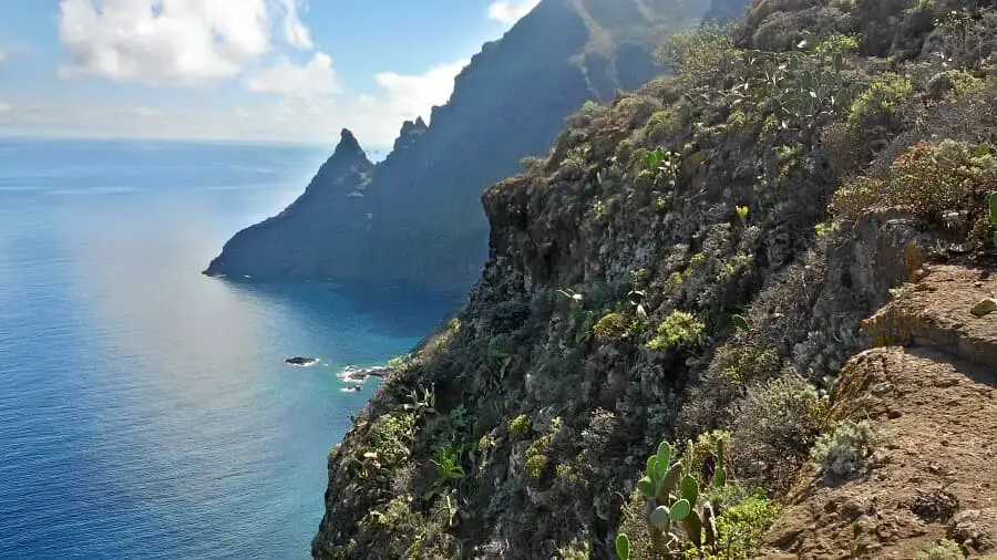
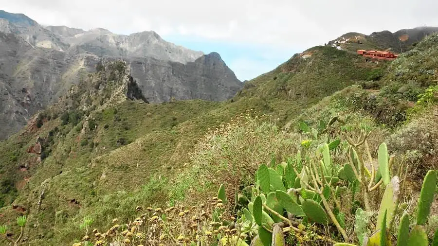
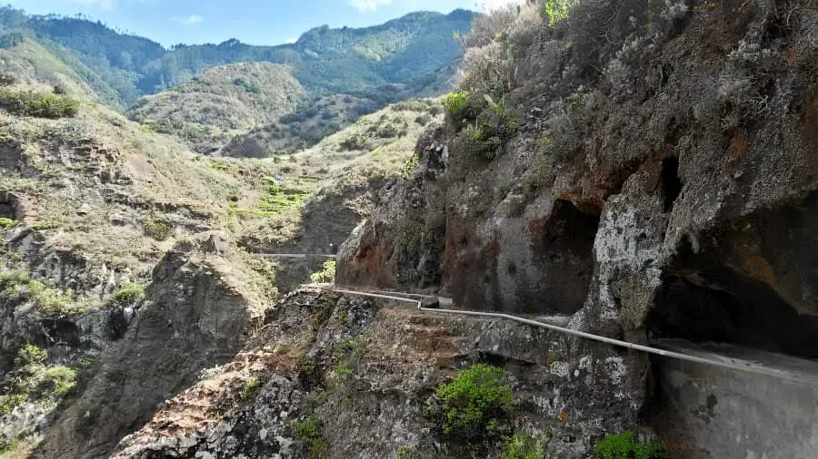
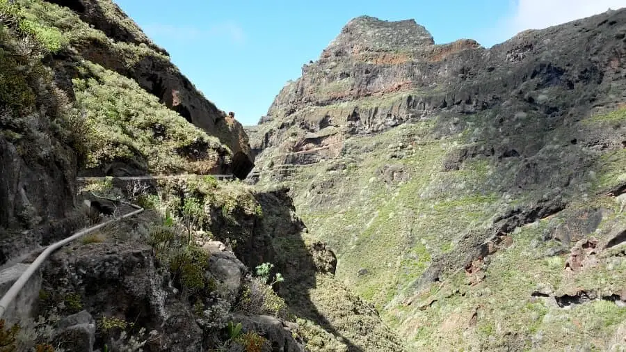
The last section leads from Los Batanes via Bejia down to Punta del Hidalgo. The hamlet of Bejia with its tranquil high valley is one of the most idyllic places in Tenerife. The path leads steadily downhill to the Canal Barranco Seco. This leads at a lofty height through the steep rock face above the Barranco Seco. The walk in and next to the intact canal is very varied. The first tunnel is 100 metres long and pitch dark in the last third. The other tunnels are very short. For the last section, 2:20 h must be planned.
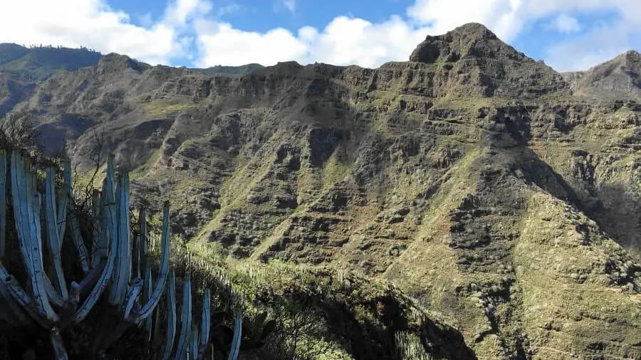
[an error occurred while processing this directive]The route profile is quite balanced. Once you have reached Chinamada, you can recover quite well on the following descent before going uphill again in Los Batanes. The last part is then to be enjoyed. The canal in the middle of the mountain range is simply magnificent. The descent to Punta del Hidalgo takes a while, but after the experience, you are happy to put up with it.
A detailed description of the route and the GPS track can be found in the Hiking Guide Tenerife.
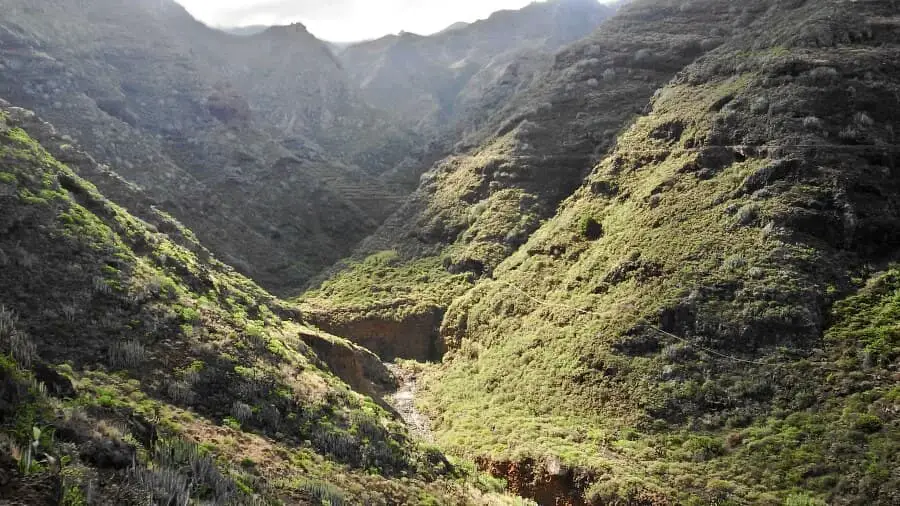
Photo Gallery