


![]()
Difficulty: middle
Fitnessn: middle
Fear of heights: middle
Surefootedness: high
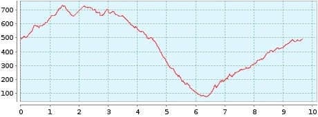
Distance: 9,66 km
Duration: 4:10 h
Heights: ![]()
![]() 686
686
Start/End:
Chamorga
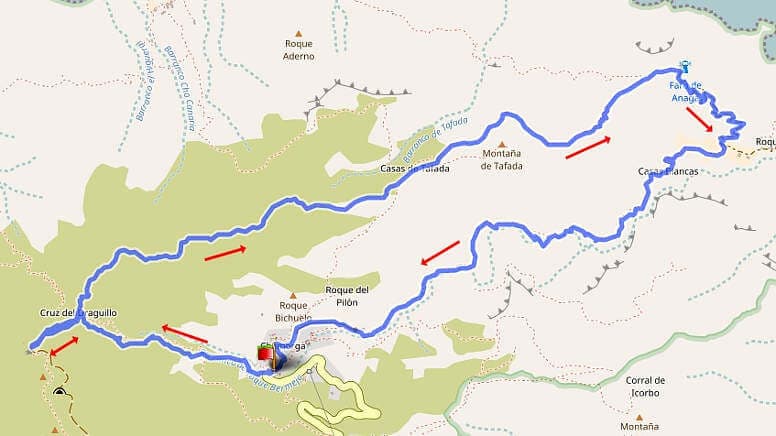

Hike 32: small trail to Faro from Chamorga
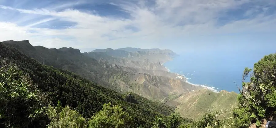
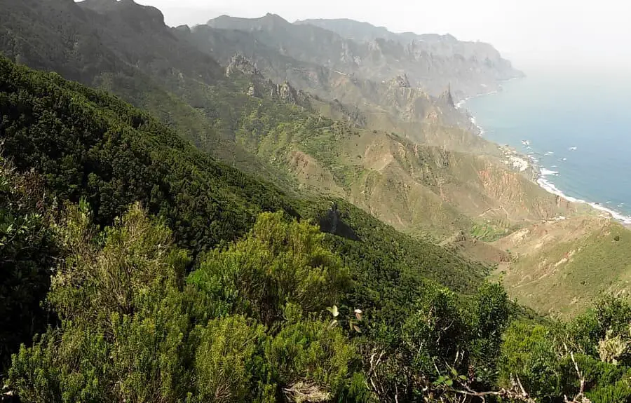
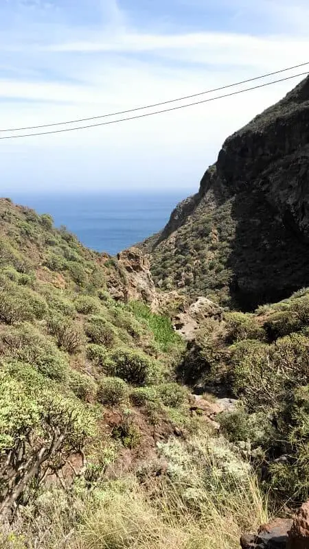
If the big Faro round (Tour 27) is too difficult for you, I recommend this hike. It offers fantastic views and a great barranco on the way back. We park at the entrance to Chamorga. There are a few parking spaces for hikers. From there we walk leisurely uphill to Cruz de Draguillo. Here we take the path on the left and first make a short detour to the Cabezo del Tejo. The view from there is simply overwhelming. The detour takes us only 20 minutes for a total of 600 metres. At the top, you have to be careful, especially on the way back, because the ground is quite soggy due to the humidity of the clouds.
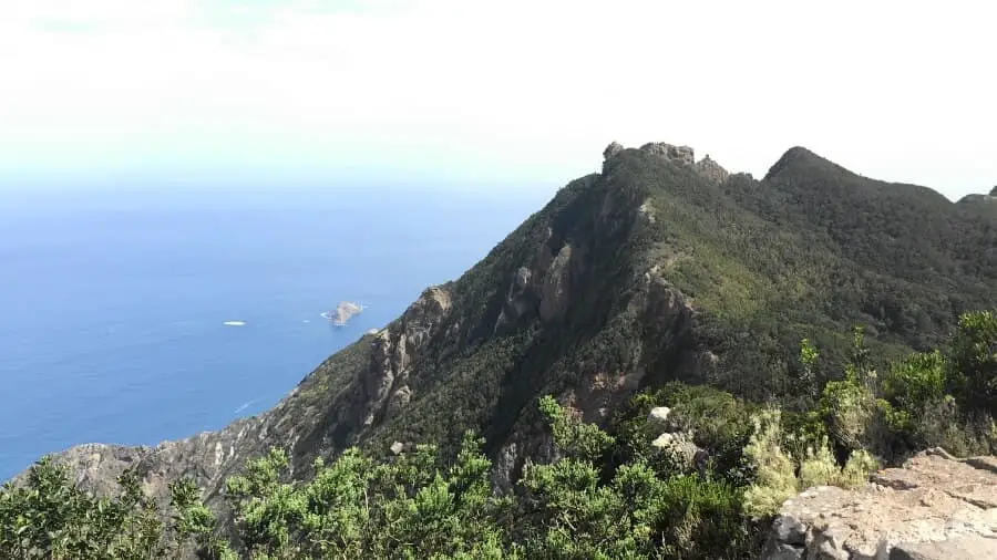
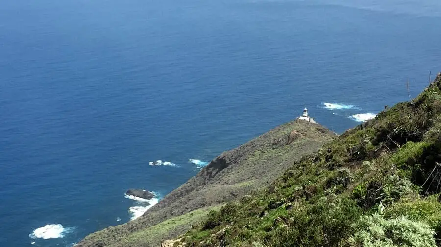
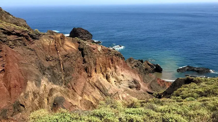
Back at the crossroads, we go straight on and after a total of 3 km begin the descent to the Faro de Anaga lighthouse. Here we take a short rest at the bench and then continue downhill into the Barranco de Roque Bermejo. This barranco is one of the most beautiful in Tenerife. Now we have to climb another 400 metres in altitude in the barranco to Chamorga. In the afternoon sun, this is quite arduous. About halfway up, there is a small watering hole in the barranco. Here we refresh ourselves for the last 2 kilometres.
You can really enjoy the Barranco if you first descend it from Chamorga, then climb up the ridge to Montana de Tafada at Faro and choose the direct descent to Chamorga from the side (Tour 38). This path is also marked as the main hiking trail there. This shortens the hike to less than 7 km.
A detailed description of the route and the GPS track can be found in the Hiking Guide Tenerife.
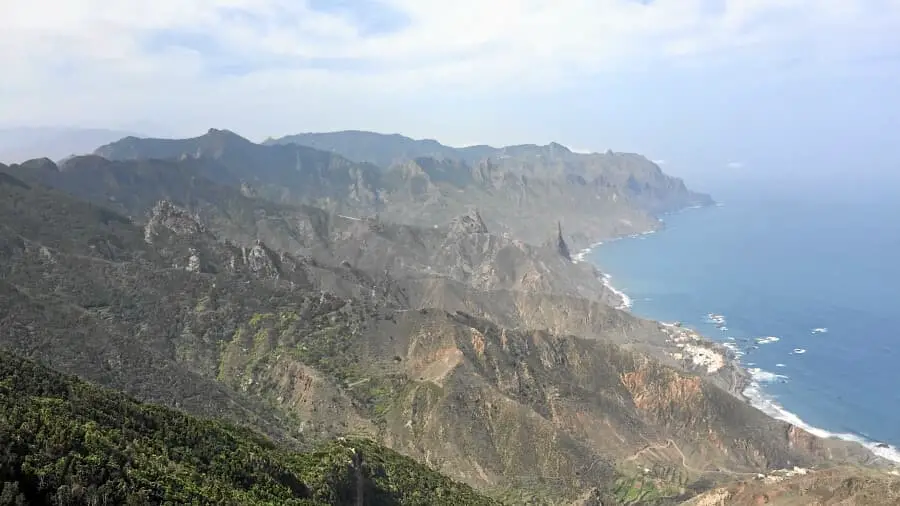
Photo Gallery