


![]()
Difficulty: middle
Fitness: middle
Fear of heights: easy
Surefootedness: middle
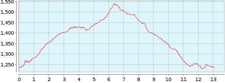
Distance: 13,08 km
Duration: 4:00 h
Heights: ![]()
![]() 345
345
Start/End:
Las Arenas Negras
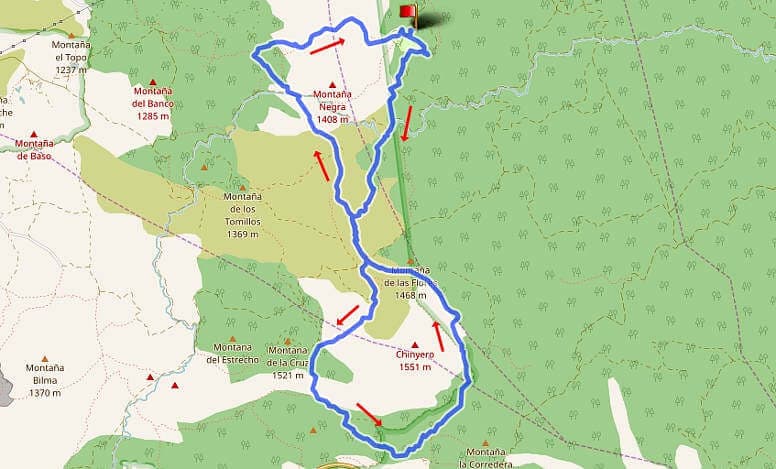

Hike 19: Chinyero Alternative
This hike is a slightly longer version of Tour 16. The start and the circumambulation of Chinyero are identical. The circumnavigation of Volcan Garachico is new. This part is a little more demanding and offers an impressive view of the Teide when visibility is good.
We started the tour on a straight path, turn right at the fork and go around Chinyero from the right. Volcan Garachico is circumnavigated starting from the left. At the upper left part of the hike, you have to hike strictly according to GPS, because no path is recognisable through the sparse pine forest.
The approach should be via Icod de los Vinos. Be sure to enter the large car park of the Arenas Negras from the lower driveway, because there are some hidden potholes on the upper one.
A detailed description of the route and the GPS track can be found in the Hiking Guide Tenerife.
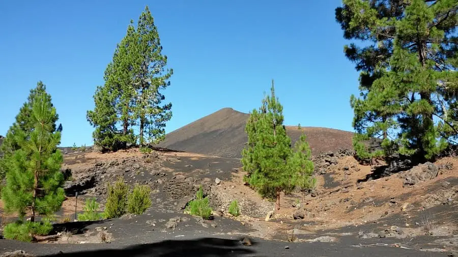
Photo Gallery