


![]()
Difficulty: middle
Fitness: middle
Fear of heights: easy
Surefootedness: middle
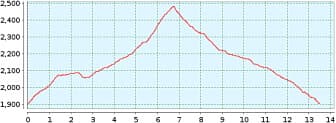
Distance: 13,49 km
Duration: 3:30 h
Heights: ![]()
![]() 597
597
Start/End:
Sendero 25 an TF-21
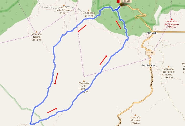

Hike 68: Montana de los Tomillos
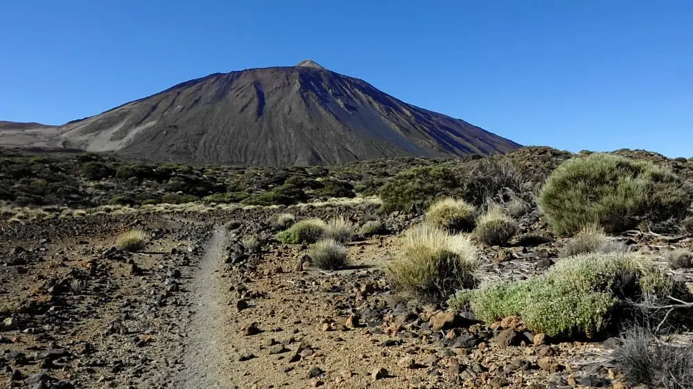
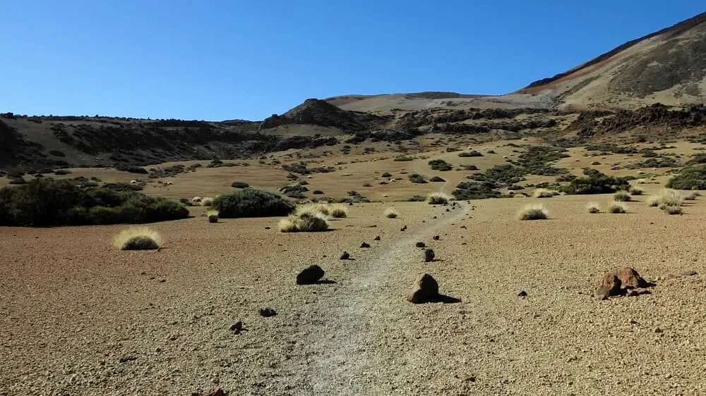
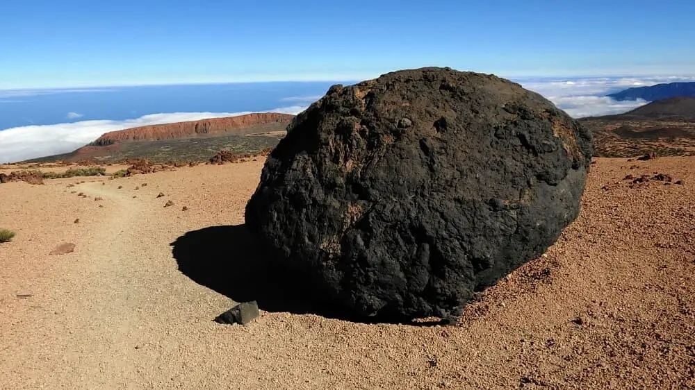
A wonderful Canadas hike leads from the Fortaleza to the ascent trail on Montana Blanca. We park at the small car park for hikers on the right side of the TF-21 after kilometre 29. First we go up to Fortaleza on the Sendero 25, although we do not pass it directly, but leave it on the right and go straight on the Sendero 22. It goes up sometimes gently and sometimes more steeply to the ascent to Montana Blanca. You can also see some Huevos del Teide. The ascent in the blazing sun from the front is quite strenuous, even in winter, and takes 2 hours. It is important to have enough water with you.
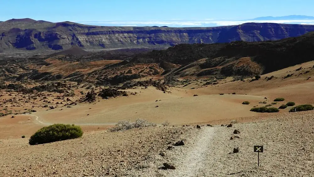
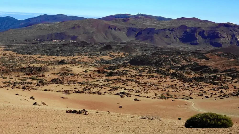
At the top we turn left and first enjoy the views into the huge Canadas crater. The descent is not very steep and we make quick progress. The views are really unique. Halfway down, the rather inconspicuous Montana de los Tomillos is on our left.
At the bottom walk 50 metres along Sendero 1 to the right and then turn left. After a good 100 metres, we take the path on the left. This is somewhat stony and also sandy. You should keep an eye on your GPS more often. After 1.5 km we are back at the car park. All in all, an interesting hike that is a bit more fun when the Teide has a light covering of snow.
A detailed description of the route and the GPS track can be found in the Hiking Guide Tenerife.
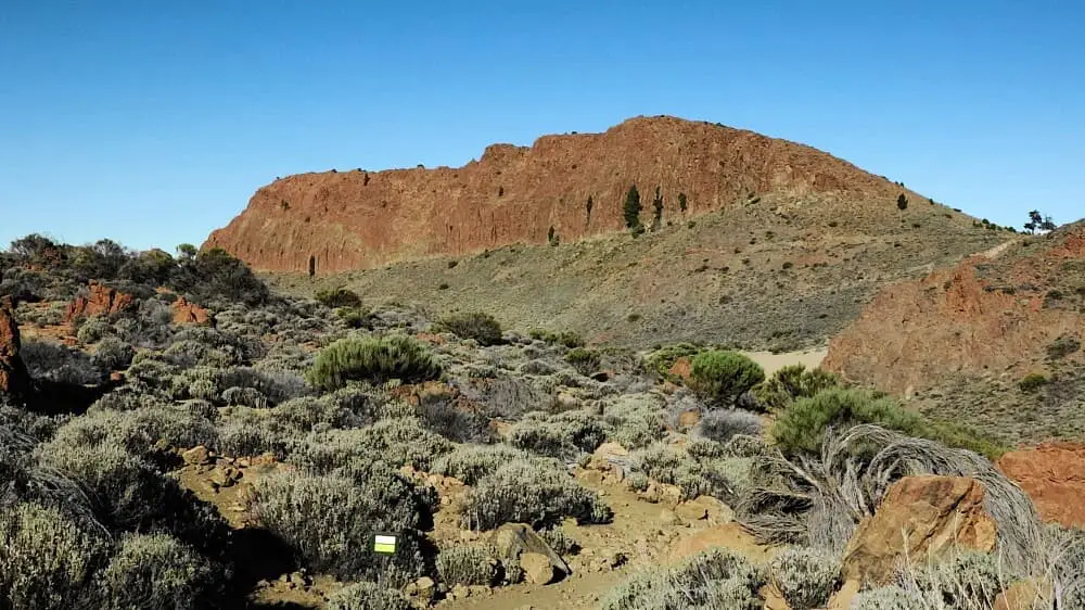
Photo Gallery