


![]()
Difficulty: middle
Fitness: middle
Fear of heights: middle
Surefootedness: middle
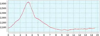
Distance: 14,61 km
Duration: 4:30 h
Heights: ![]()
![]() 631
631
Start/End: Mirador
de Narices del Teide
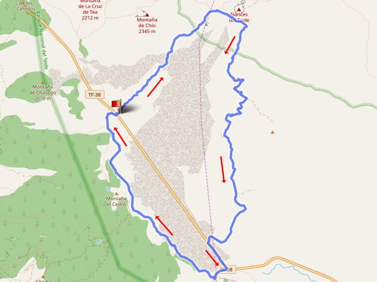

Hike 72: Narices del Teide
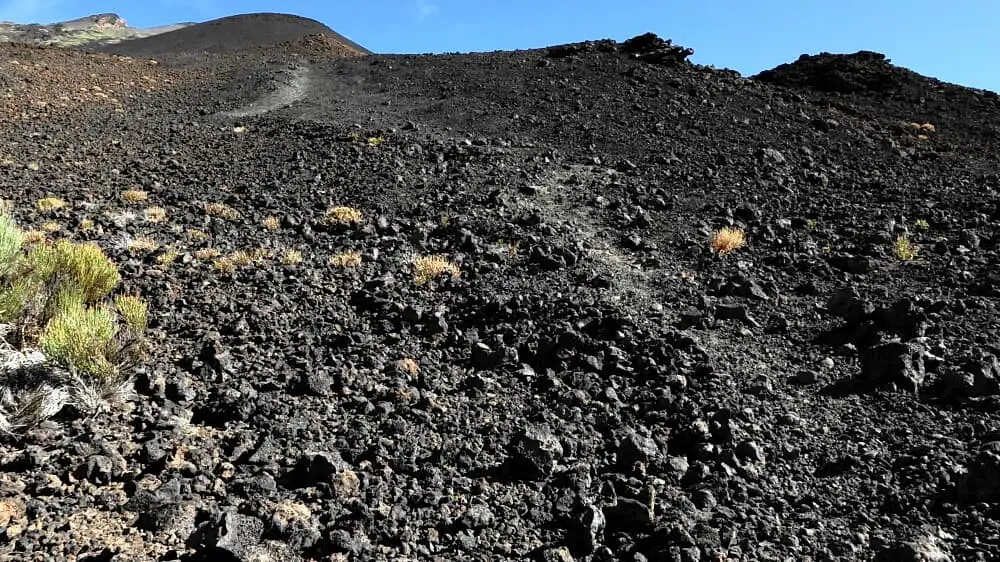
This hike in the Canadas is an absolute highlight. You don't always have to go to the highest peak to experience spectacular views. We park the car at the Mirador de Narices del Teide. There are enough parking spaces. Then we cross a scree field exactly at right angles to the TF-38. The GPS tracker should be set to a high zoom level (20 metres). Now we follow the GPS instructions exactly and take the barely visible path. It leads us past various cairns and along sections of path that we would not have recognised as paths. Slight corrections in case of deviations are no problem. After about 1.6 km we have to cross a black lava field. Here we have to keep exactly to the instructions. In doing so, we briefly descend into the bottom of the field and ascend again on the opposite side. The whole thing is done within 50 metres. After crossing, we see the entrance with a tree stump on the opposite side.
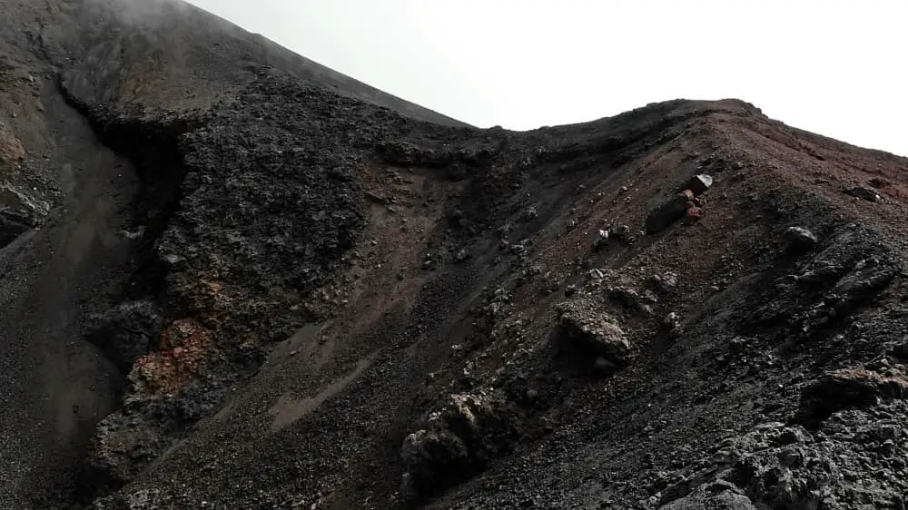
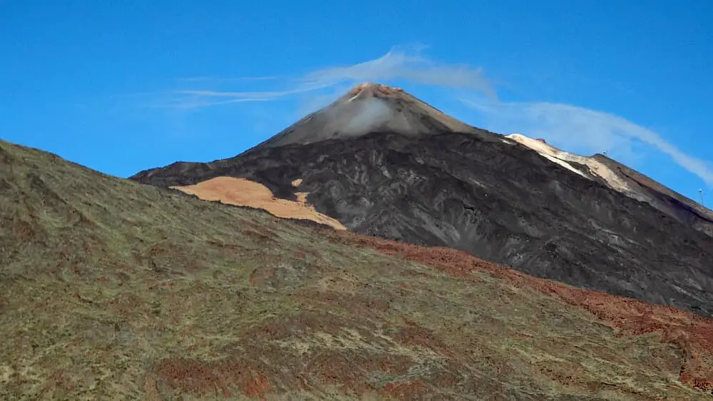
Now we climb up to the Narices del Teide. The glowing hot lava flowed out of them during the last eruption in 1798. We pass the nostrils from below. The Narices are the highest point of the hike. We hike to the right onto Sendero 28 and descend slightly towards Boca Tauce. The path becomes a little steeper and uneven after a short while. As the trail progresses, it loses the bumps and we make good progress.
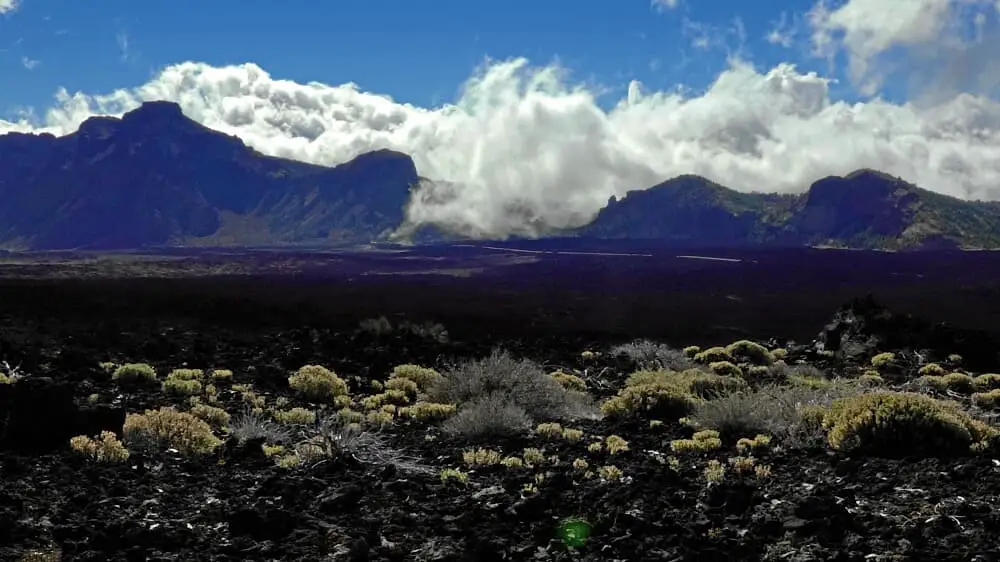
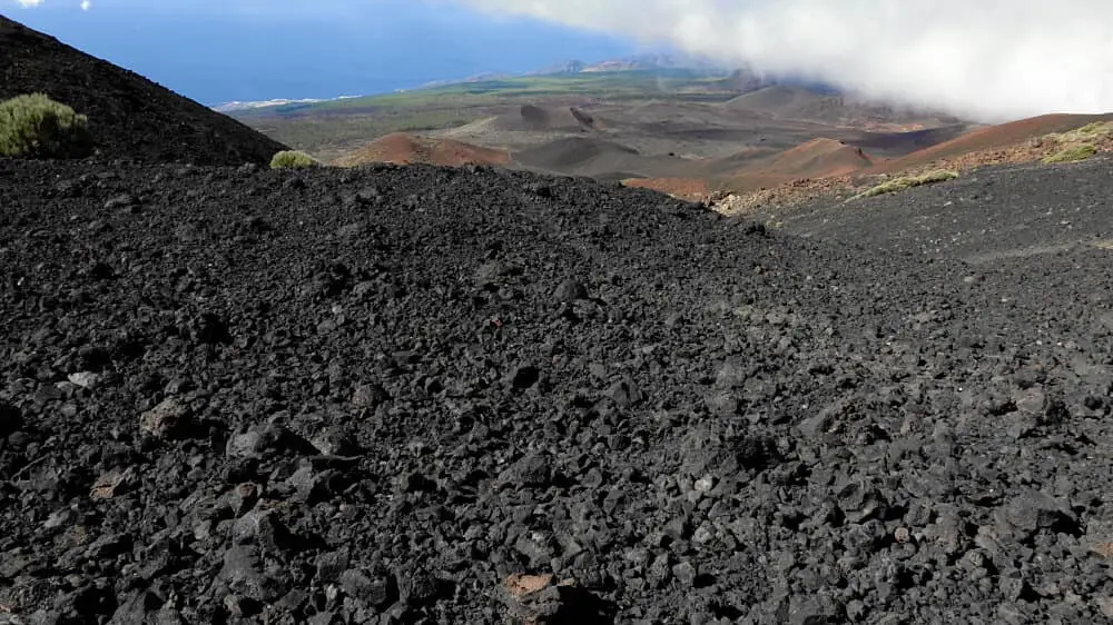
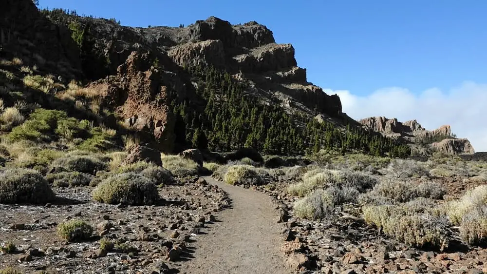
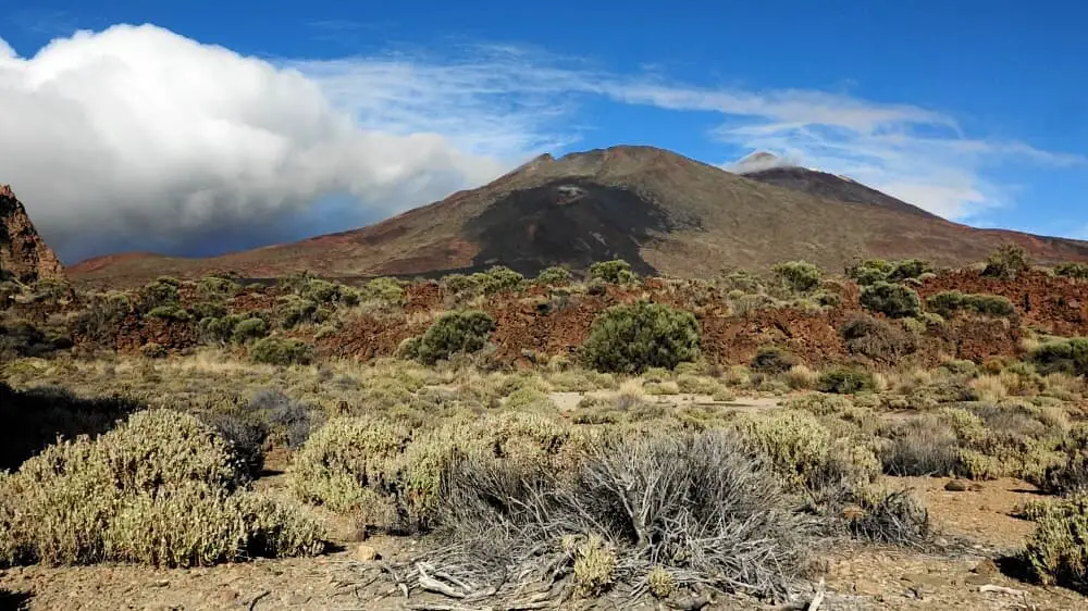
At Boca Tauce we take the TF-38 to the left and then turn right onto the TF-21. After 200 metres we turn right onto the Sendero 18. The sandy path leads us first past the Tiro del Guanche, then onto a lava field that is easy to walk on. Shortly afterwards we walk on lava sand again. All along Sendero 18 we have wonderful views of parts of the Canadas crater, Teide and Pico Viejo. We can once again take a good look at the Narices del Teide from a distance.
This hike is really varied, still easily doable in terms of effort and offers wonderful views. I did it in winter. Thick clothing, hats and gloves are highly recommended at around 0°. Although there were low clouds in the Canadas, the visibility in the Narices area was good.
A detailed description of the route and the GPS track can be found in the Hiking Guide Tenerife.
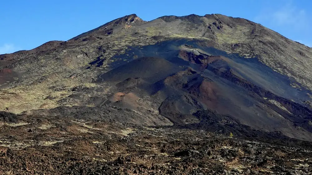
Photo Gallery