


![]()
Difficulty: easy
Fitness: easy
Fear of heights: easy
Surefootedness: easy
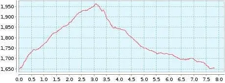
Distance: 7,82 km
Duration: 2:30 h
Heights: ![]()
![]() 315
315
Start/End:
Pista Madre del Agua
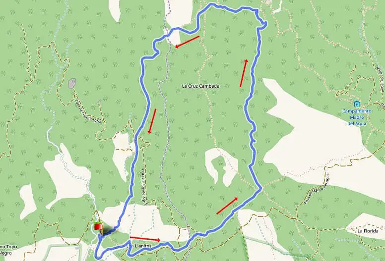

Hike 3: Paisaje Lunar
This is a beautiful complementary tour in a charming landscape. You can get there by following the road for about 3.5 km at km 66 (TF-21 Vilaflor-Canadas) and parking there.
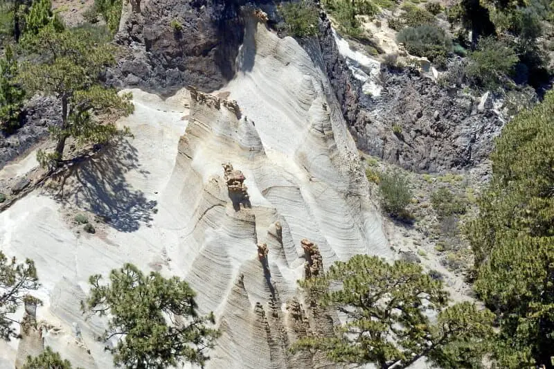
Unfortunately direct access to the minarets is blocked. So you can only see them from a distance. Therefore, you should use a camera with a telephoto lens.
A detailed description of the route and the GPS track can be found in the Hiking Guide Tenerife.

Photo Gallery
The Paisaje Lunar was formed by the erosion of tufa.
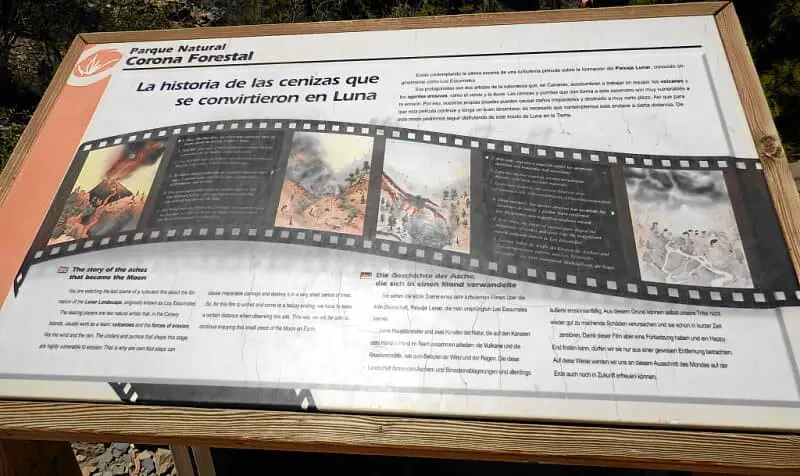
Text of the plaque on the Paisaje Lunar:
The story of the ashes that turned into a moon.
You are watching the last scene of a turbulent film about the lunar landscape, Paisaje Lunar, originally called Los Escurriales. Its main characters are two artists of nature who always work together hand in hand in the Canary Islands: the volcanoes and the forces of erosion, such as the wind and the rain.
However the ash and pumice deposits that form this landscape are extremely susceptible to erosion. For this reason even footsteps can cause irreparable damage and destroy them in a short time.
But in order for this film to have a sequel and find a happy ending, we must only view it from a certain distance. In this way, we will still be able to enjoy this excerpt of the moon on earth in the future.