


![]()
Difficulty: easy
Fitness: easy
Fear of heights: easy
Surefootedness: middle
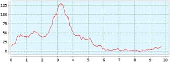
Distance: 9,74 km
Duration: 2:10 h
Heights: ![]()
![]() 156
156
Start/End:
Palm Mar
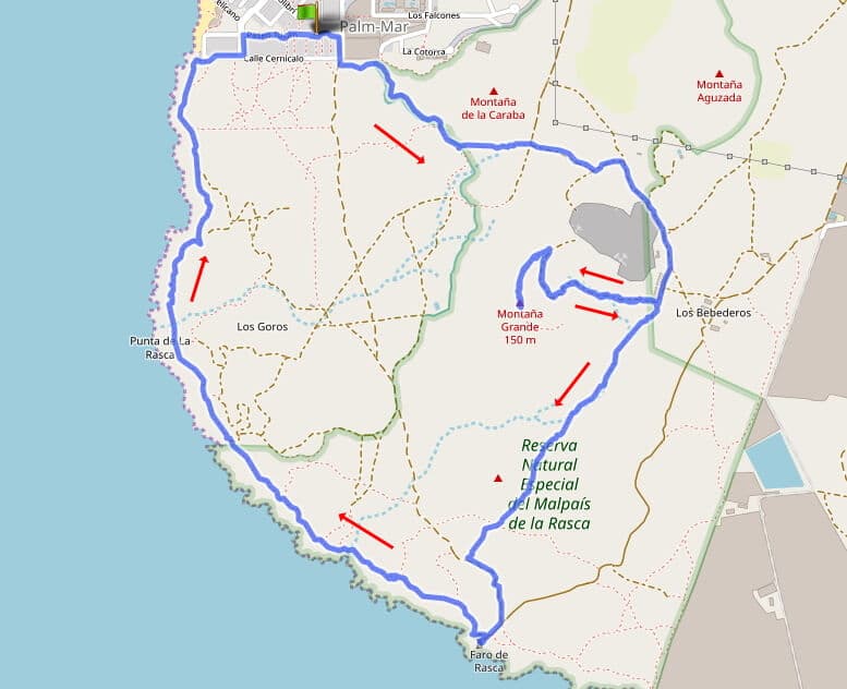

Hike 66: Palm Mar/Malpais de la Rasca
Efinally I was able to go on another hike in the south of Tenerife. Palm Mar is about 10 km west of the airport south. Take the Guaza exit from the TF-1, drive towards Palm Mar all the way down and then park in the Paseo Tucan. From here, go to the upper part of Malpais de la Rasca.
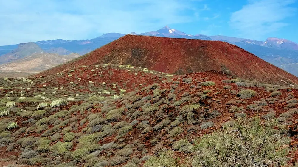
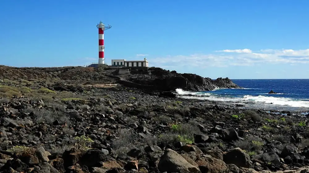
After a short while we pass a small company site. There you can climb Montana Grande (150 m). What is a small mound in the Canadas is a real mountain in the south. The ascent/descent is 2 km with 100 m altitude difference and takes 40 minutes. The views are quite nice (see picture gallery). After the descent, we continue to Faro de Rasca.
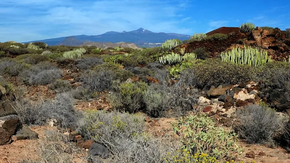
Directly at the lighthouse we take a hard right. The sometimes uneven path now leads us through the Mailpais de la Rasca. From time to time, the remains of old stone houses (goros) can be seen. Families spent the summer here and devoted themselves to fishing, catching seafood and grazing. As in the Malpais de Güimar, there are also candelabra spurge plants here. However, the scenery is a little more beautiful here, because you have wonderful views of the Teide. If you live in the south, I recommend this short loop.
A detailed description of the route and the GPS track can be found in the Hiking Guide Tenerife.
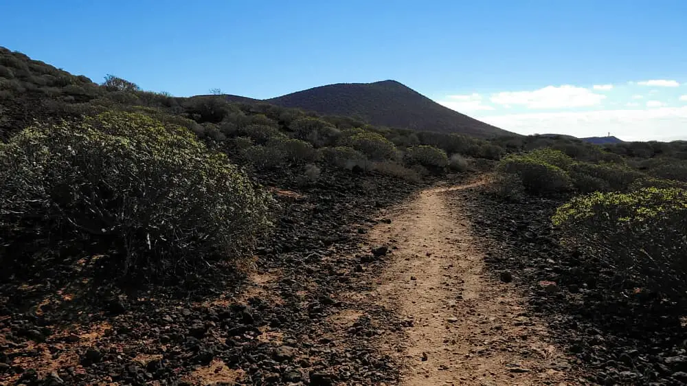
Photo Gallery