


![]()
Difficulty: easy
Fitness: easy
Fear of heights: middle
Surefootedness: middle
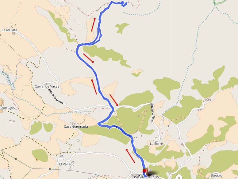
Distance: 4,17 km
Duration: 1:50 h
Heights: ![]()
![]() 173
173
Start/End:
Teno Alto

Hike 36: Risco steep track Alternative
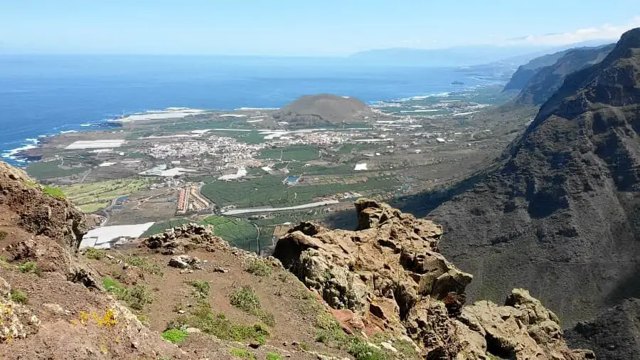
This variant of Tour 28 is a much shorter route from Teno Alto (Los Bailaderos) to the Riscosteig. By car, you drive from El Palmar along a forest road to Teno Alto and park in the small village near the church. The path leads 800 metres along a forest road to a crossroads. Here the Camino del Risco begins to descend gently. After heavy rainfall, the path is slippery and the ground crumbles under your hiking boots.
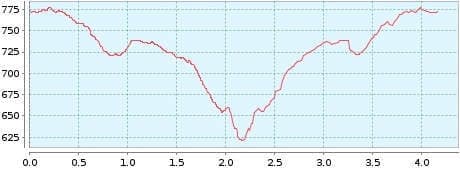
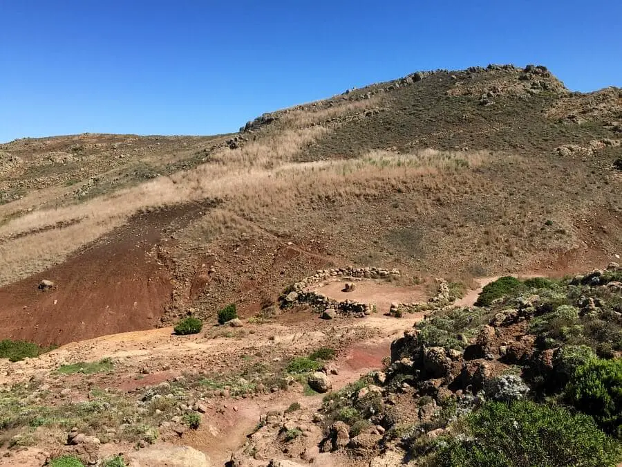
After about an hour, we reach an old Guanche site and turn right into the path. We walk down this path for a few metres and can enjoy breathtaking views. You should be free from vertigo for this short part or just walk down a few metres. The view with a view of the Teide is magnificent up here.
Then we return the same way to Teno Alto. A detour to Roque del Toscon from the Guanche site is absolutely not worth it. We also tried a round trip over La Mulata. But the slope path turned out to be a maze and there were no good views either. For those who want to combine an easy hike with magnificent views, I can highly recommend this tour. If this tour is a bit too easy for you, you can do tour 28 from the Tabaiba Pass to the Riscosteig and back.
A detailed description of the route and the GPS track can be found in the Hiking Guide Tenerife.
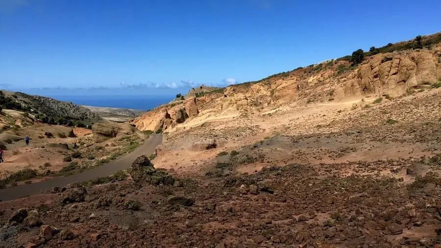
Photo Gallery