


![]()
Difficulty: high
Fitness: high
Fear of heights: high
Surefootedness: high
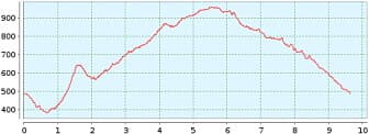
Distance: 9,64 km
Duration: 4:30 h
Heights: ![]()
![]() 656
656
Start/End:
Mirador Baracan
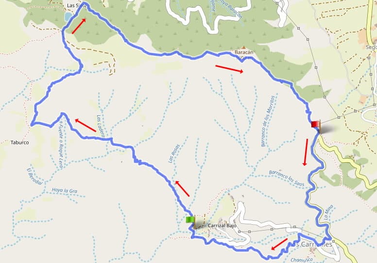

Hike 69: Taburco/Baracan
This hike is very difficult due to the nature of the path and orientation. I present it here to point out the danger. Only with alpine experience, good physical condition, 2 litres of water and a good sense of orientation can you tackle the hike. The track plotted in OSM is problematic, as the author has often missed the safe route. My track recording also has weaknesses, because I initially orientated myself on the OSM map, returned when the path was missing on the steep slope and looked for a safe variant and also did not always find it.
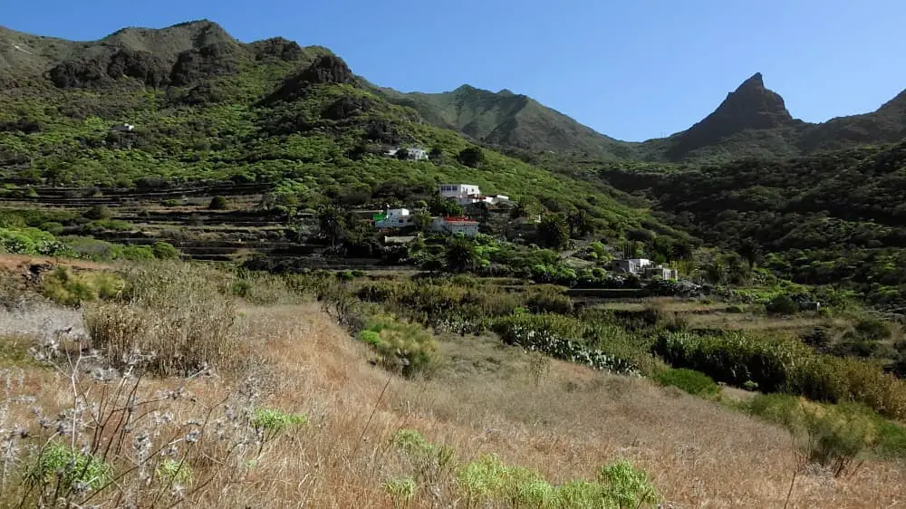
The beginning is completely harmless. We park the car at Mirador de Baracan and walk 1.3 km down the TF-436 to Carrizal Alto. Here we walk a short distance into the village and then a well-signposted easy path begins to the left. This path leads us to Carrizal Bajo. At a bend, we leave the road and continue straight ahead on a hiking trail. This ends after 200 metres. A path into the Barranco de Carrizales begins directly in front of us.
We go up the slope to the right here. The search for the optimal path begins. Here you can still orientate yourself well on the
offline map from OsmAnd and my recording. The path is still very safe and you can always turn back and look for an alternative. The
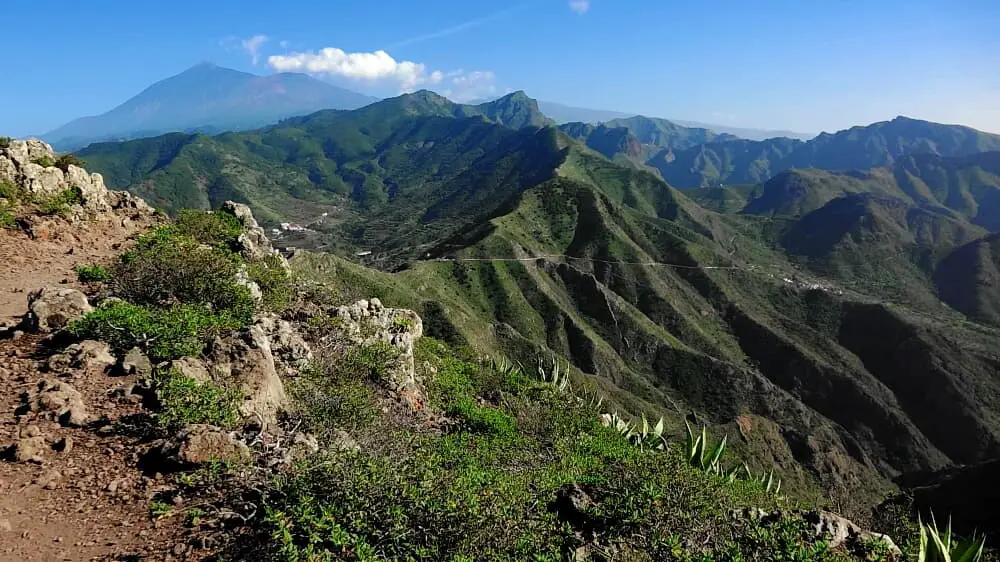
views to Carrizal Bajo always remind me of Masca.
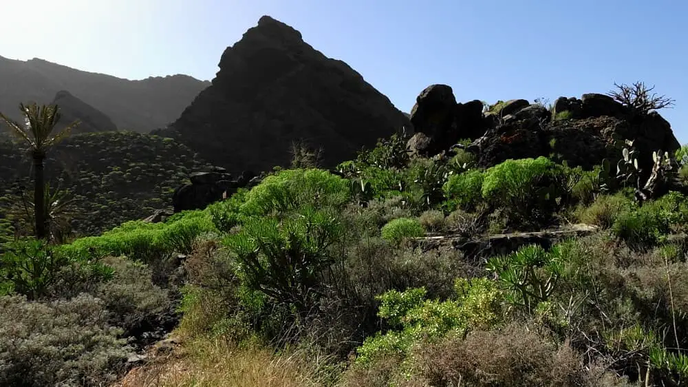
Suddenly we find ourselves in a steep ascent. The safe path is often not recognisable. After a few critical spots, the point of no return was reached. We climb a ridge with a clearly visible cross. It is very steep and at the highest point you can hardly find a foothold. According to the OSM map, the path behind the cross is on the right side. Here the author of the OSM map has made a mistake. The descent is too steep. So I go back to the ridge and keep to the left of the summit cross. Actually I want to turn back, but I can't find the entrance for the way back. It is pure coincidence that I recognise a further path. After a few metres, it makes a hard turn to the right.
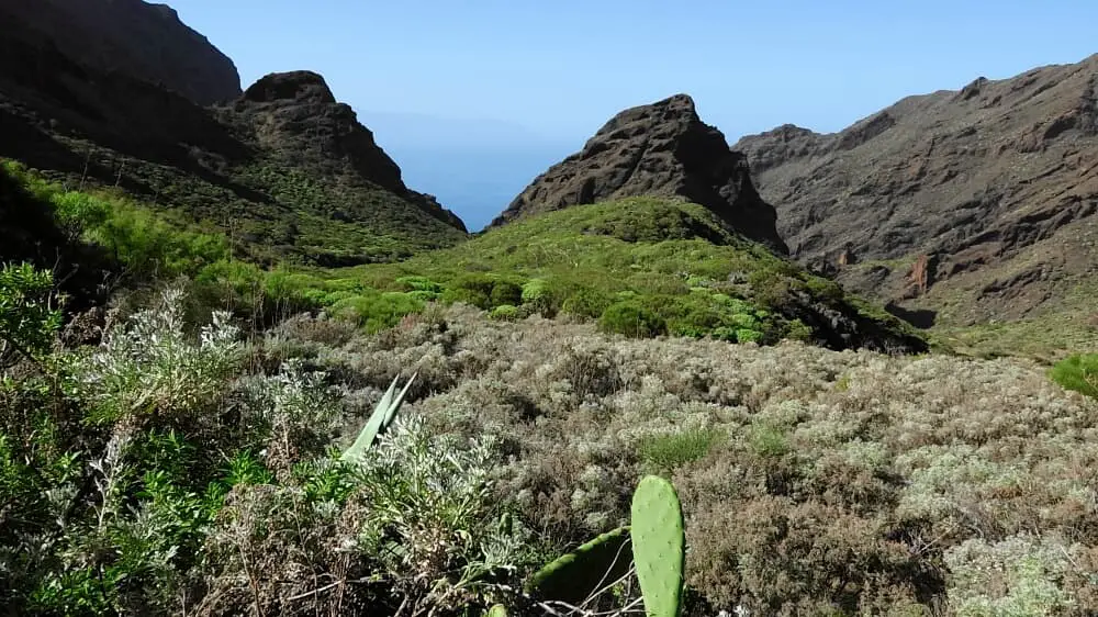
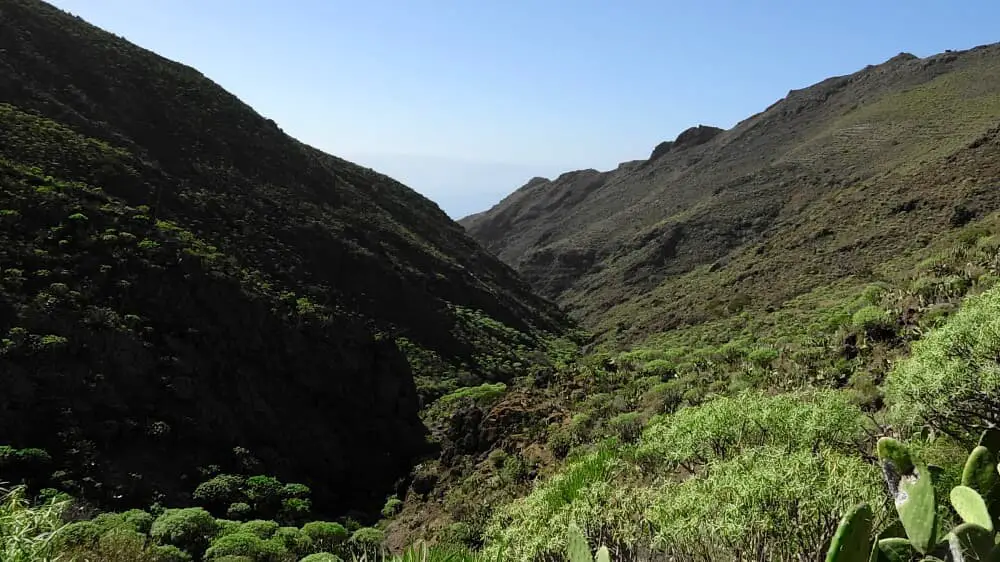
So I go on and on. Sometimes I can cover 500 metres safely. Sometimes I have to fight for every metre. The sun is behind and heats me up. 2 litres of water are the minimum. Then I have made it down the slope. The next slope ascent is in front of me. I find myself in the Taburco. Sometimes it goes up, then down again. Further up, the path becomes safer and more recognisable. Nevertheless, there are always situations where you can miss the path.
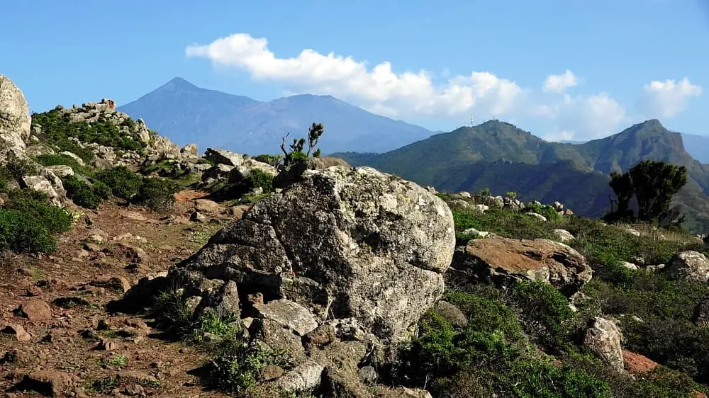
After 3 hours of strenuous climbing without shade, I reach a road. In front of me I see the water reservoir at Teno Alto on the left. I have made it. I am on the Camino de Baracan. The rest is a mere formality on a bumpy but safe hiking trail to the Mirador de Baracan. After an hour I reach the starting point. The hike requires a lot of energy reserves and the utmost concentration. Unfortunately, you can only enjoy the beautiful nature for a short time. Please only do it if you meet all the conditions mentioned above.
A detailed description of the route and the GPS track can be found in the Hiking Guide Tenerife.
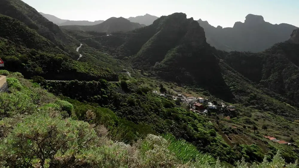
Photo Gallery