

 Wanderführer
in deutsch
Wanderführer
in deutsch  Guía de
Senderismo de Tenerife
Guía de
Senderismo de TenerifeHiking-Guide Tenerife with GPS-Tracks
The Hiking-Guide contains 91 actual Tours. I have walked all of them myself and use my own GPS records. Detours I have taken have been corrected.
Reviews from clients: 5.0 of 6
(6) - very good
(0) - good
(0) - average
(0) - bad
(0) - very bad


Excerpt from reviews:
Werner wrote: Simply brilliant!
The best I've used in the last 20 years on Tenerife. All the main hiking
highlights are included, absolutely reliable and convenient, great in conjunction with OSM, it's also possible to reverse the tour, so you're
extremely flexible.
My 100% recommendation of this great hiking guide!
Dieter wrote: The hiking guide was a great help in planning: lots of tour suggestions (we did 12 of
them), reliable information, GPX tracks - just great.
The Hiking-Guide contains:
- all Tours from this site as PDF
- one site in A4 contains a tour for printing
- online/offline view from every tour optimized for smartphones
- OSM maps, elevation profiles, GPS tracking and current information on closures in the smartphone app
- all necessary bus connections included
- links for bookings to Teide, Barranco del Infierno and Chinobre
- bullet-point, comprehensible and unambiguous references
- all GPS-Tracks inkluding
- free updates on request
- payment via PayPal including buyer protection
- prompt provision of the download via external service provider (droppy.ch) as well as programming and activation of the access data
only 14,90 € (including updates)
Buy now with PayPal including buyer protection:
The download is in the form of a zip file. You can unzip the file as follows:
- on the PC double-click on the file and the hiking guide and the GPS tracks appear
- on the Mac after this Instruction
- on the iPhone or iPad after this Instruction
- on an Android smartphone according to this Instruction
What do you get?
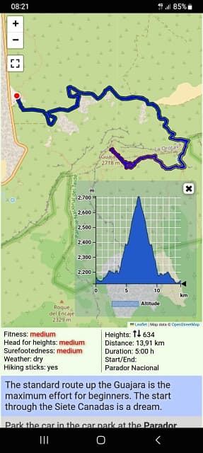
You will receive a pdf file to print out. Each hike is presented in the current issue in landscape format on one A4 page. The most important information is at the top left, below that the graphics and on the right the complete description in key points in large font. Here you can download an example.
online/offline-view
Additionally you get access to the Service-Area on this site. There you will find all tour descriptions optimally prepared for smartphones, including current information such as closed paths. To use a description offline, you only need to download the page in the browser. You no longer need a printout when you are on the road. Bus connections and all GPS tracks are also included.
reasonable routing
A sensible route means that the steep ascent is done at the beginning when you are still fresh. Then a recovery phase
follows and the descent should be the longer section to spare the joints. Knowing this, one should prefer the Taganana route to the
Afur variant in order to put the ascent to Afur at the beginning. Walking poles should always be used, except on very easy tours. On
the ascent you save strength by using your arms and on the descent you can cushion your joints with your arms.
free Updates
The updates are free of charge. However, due to the rights of the EU, they must be requested. If you see after the purchase that the number of tours has increased, please write to me at the mail address of the imprint. You will then receive the download link by mail.
Screenshot online/offline-view
Release Notes:
10.3.2024: Release 10.2
- GPS-Tracking online/offline-App
23.2.2024: Release 10.1
- Redesgin online/offline-App
26.10.2022: Release 10
- additional information Barranco Masca
- test closed hiking trails
- 5 new tracks
13.3.2022: Release 9.4
- change tour Masca/Santiago del Teide
23.2.2022: Release 9.3
- examination of TITSA bus connections
- updates prices
22.2.2022: Release 9.2
- implementing spanish version
5.2.2022: Release 9.1
- implementing english version
30.1.2022: Release 9
- change tour Barranco Masca
- including photos in the service area
21.12.2019: Release 8
- 11 new tracks
29.1.2019: Release 7
- 10 new tracks
- new format for a better view
6.7.2018: Release 6.1
- new Service-Area for online/offline-view
4.9.2017: Release 6
- examination of TITSA bus connections
- creation of a separate timetable
5.5.2017: Release 5
- 5 new tracks
3.3.2017: Release 4
- 7 new tracks
13.5.2016: Release 3
- 3 new tracks
24.4.2016: Release 2
- change tour Chanajiga - Fortaleza
- 9 new tracks
9.3.2016: Release 1
- preparation 41 tracks