


![]()
Difficulty: high
Fitness: high
Fear of heights: middle
Surefootedness: high
Distance: 15,57 km
Duration: 6:30 h
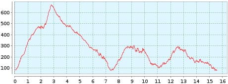
Heights: ![]()
![]() 1015
1015
Start/End:
End of Benijo
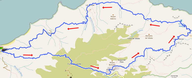

Hike 56: Benijo/Chamorga/Faro
11.10.2022: closed trail
The section from Faro de Anaga to El Draguillo is closed due to falling stones and rock slides. I tested the path and some areas are very narrow and slippery. Further restrictions must be expected. The hike is not recommended until further notice.
This hike is even better than Tour 27 and offers all the highlights in this area. It is a bit more difficult, but still manageable due to the route. First the difficult ascent, then a leisurely walk to Chamorga. This is followed by the descent through the Barranco Bermejo and the impressive panoramic path back along the Atlantic.
We park in Benijo just behind the El Fronton restaurant and hike up to the Cruz del Draguillo. There are 550 metres of ascent. At the beginning of the tour, we manage this climb without any problems. After that it becomes more relaxed, because it goes downhill to Chamorga. But you should be careful in this section, because the damp ground in the laurel forest can be a bit slippery.
The most beautiful part of this hike follows. Downhill we walk the evergreen Barranco Bermejo to the Atlantic Ocean. A 4 km long and
beautiful path makes you forget the efforts before. Here, too, as in every barranco, a high level of surefootedness is necessary.
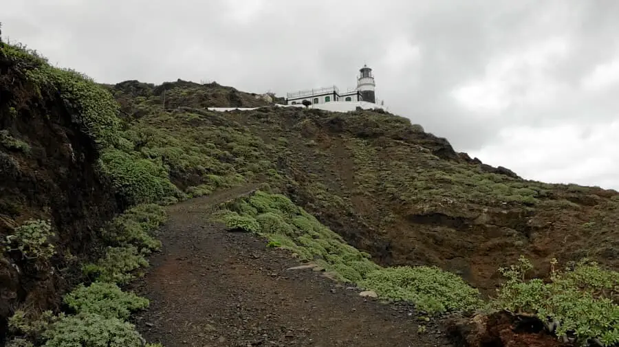
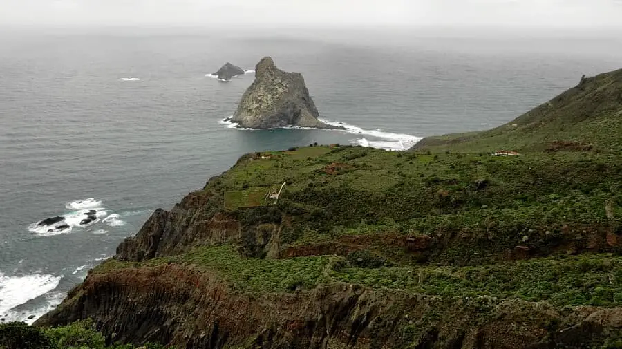
The path climbs another 200 metres to Faro de Anaga. We take a short rest at a bench behind the lighthouse. The path now leads to the right directly along the Atlantic Ocean in the direction of Benijo. It goes slightly downhill again. Then there is another climb to Las Palmas. There are still some huts here. A hermit lives there with his donkey. We always stay on the main path. We have to pass some ridges and suddenly we see Taganana in the distance in front of us. The impressive view of the coastal strip accompanies us until the end of the hike. We pass El Draguillo and from here we go back to Benijo on a forest road.
Sure this hike is quite difficult overall. But the advantage is that you take the greatest effort at the beginning when you are still fresh. After that comes a recovery phase and the rest is then 2 ascents of 200 metres in altitude each. Overall, the tour is doable with a bit of fitness. Beginners should start with tour 32 or 38. After the tour, you can reward yourself immediately and stop at the restaurant "El Fronton".
A detailed description of the route and the GPS track can be found in the Hiking Guide Tenerife.

Photo Gallery
