


 8,14 668
 6,73 404
 6,81 299


![]()
Difficulty: middle
Fitness: middle
Fear of heights: middle
Surefootedness: high
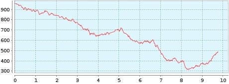
Distance: 9,75 km
Duration: 4:10 h
Heights: ![]() 310
310 ![]() 796
796
Start/End:
Cruz del Carmen

Chinamada/Batan
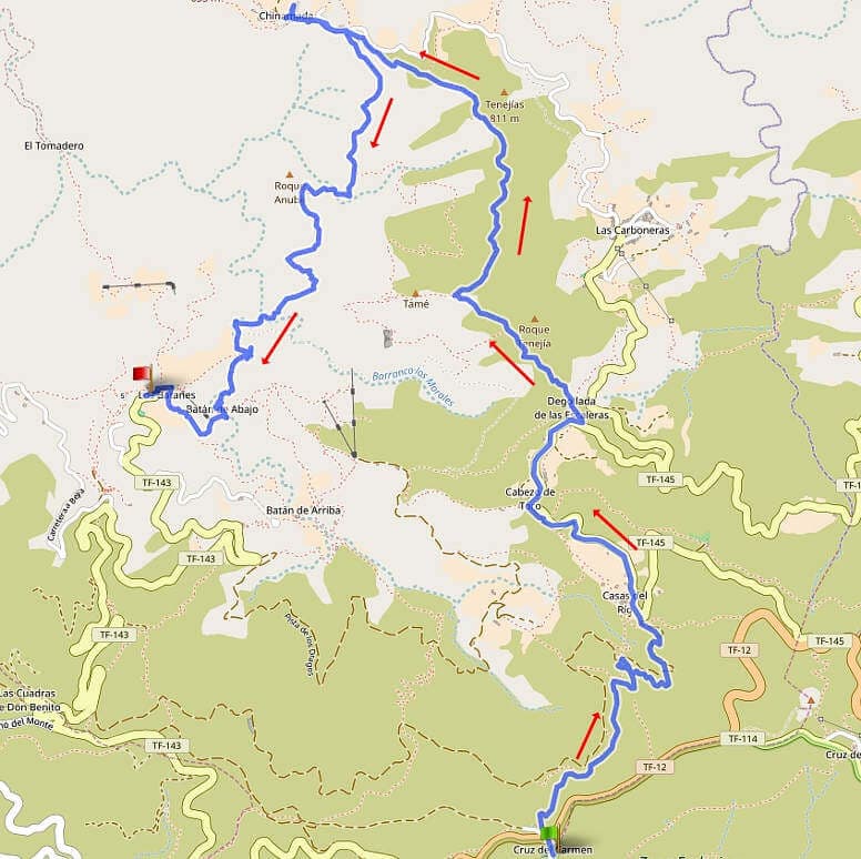
The hike leads from Cruz del Carmen first through cloud forest to Degollada de Las Escaleras. On the high trail, we pass Casa Tame and continue to the lonely cave village of Chinamada. Here, 15 people still live in caves and farm on terraced fields. It is worth taking a break in the only restaurant in the village.
The descent to Batan de Abajo leads through the Barranco del Rio and is exposed in some places. At one airy spot, steps cut into the rock have to be overcome. Due to the nature of the trail, this section should only be done in dry weather.
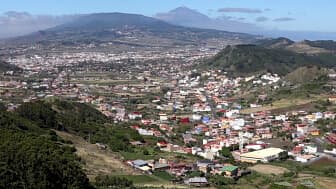
view from Cruz del Carmen to Teide
The 4 km long way back to Cruz del Carmen is given in Rother as 2 hours, whereby 480 metres of altitude difference have to be overcome on the way up. We did without and took bus 274 (15:00 weekends, 15:50 Mon-Fri) from Batan in the direction of La Laguna. You go up to Cruz el Batan and walk the last part through cloud forest to Cruz del Carmen.
A detailed description of the route and the GPS track can be found in the Hiking Guide Tenerife.
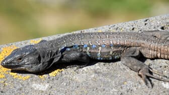
The male of the southern Canary Island lizard is mainly found in the south and centre of Tenerife. However, this specimen was in the Anaga at Cruz del Carmen. All 3 subspecies of Canary Island lizards are descended from the now extinct giant lizards. These grew to be over 1.5 metres long.
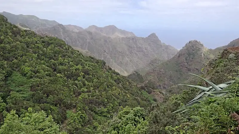
Photo Gallery
Review Hike