


![]()
Difficulty: easy
Fitness: easy
Fear of heights: easy
Surefootedness: middle
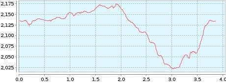
Distance: 3,86 km
Duration: 1:50 h
Heights: ![]()
![]() 159
159
Start/End:
Parador Nacional


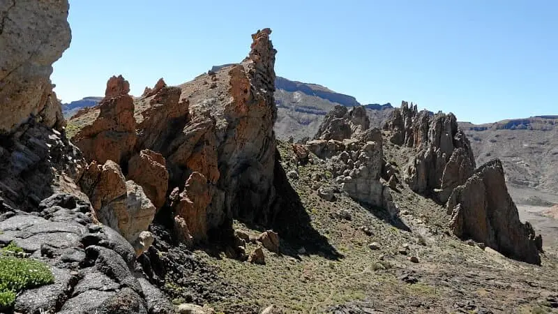
Hike 2: Roques de Garcia
At first I had only planned this hike as a substitute or supplement because of its short length. However the tour is an absolute highlight and offers spectacular views of a bizarre rock group of the Canadas and should definitely be done.
Hordes of tourists are driven here in buses all day to watch the spectacle. But if you walk the described path for only 5 minutes, you will see and hear nothing more of them. The loop starts as a walk and has a small climb at the end. Overall, it is easy to do and can also be combined with another short tour (1, 3, 5).
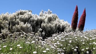
Teide broom, hairy featherhead and wildpret adderhead like to appear as a trio on the Roques.
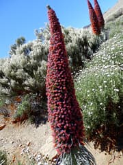
The wildpret viper's bugloss grows in the Canadas at an altitude of 1800 to 2300 metres. The candle-like red inflorescences grow up to 3 metres high. Thousands of flowers bloom one after the other from the base to the top. This allows the inflorescence to be visited by insects over a longer period of time.
A detailed description of the route and the GPS track can be found in the Hiking Guide Tenerife.
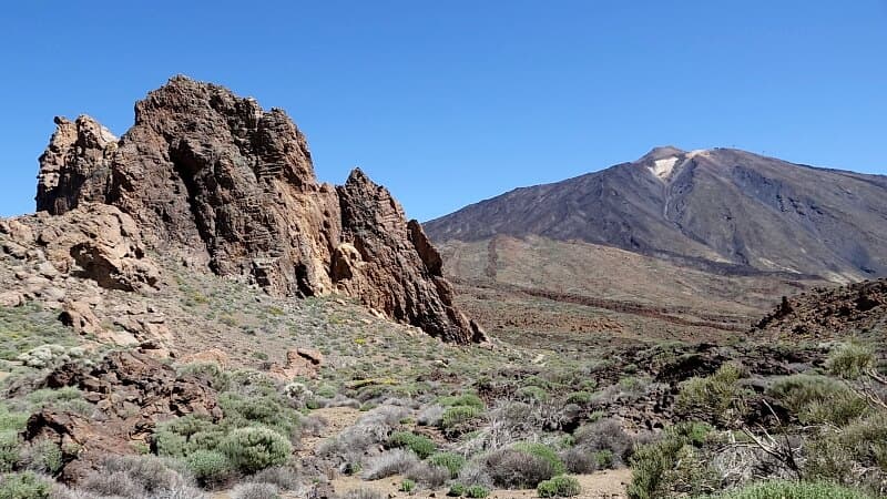
Photo Gallery