


![]()
Difficulty: high
Fitness: high
Fear of heights: high
Surefootedness: high
Distance: 9,51 km
Duration: 4:00 h
Heights: ![]() 1255
1255 ![]() 70
70
Start/End: TF-21
Ende: Teleferico

Hike 30: ascent to Teide
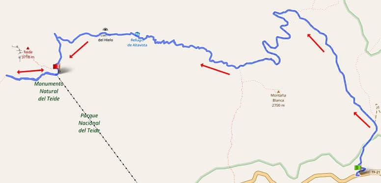
After we climbed the Teide summit in tour 4, it was now time to hike Teide without Teleferico. We didn't take the summit in this tour because the permits were booked up months in advance. Besides, I think it is enough to have visited the summit once.
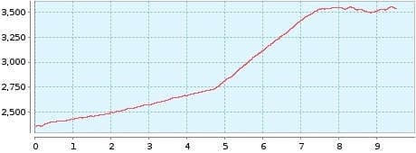
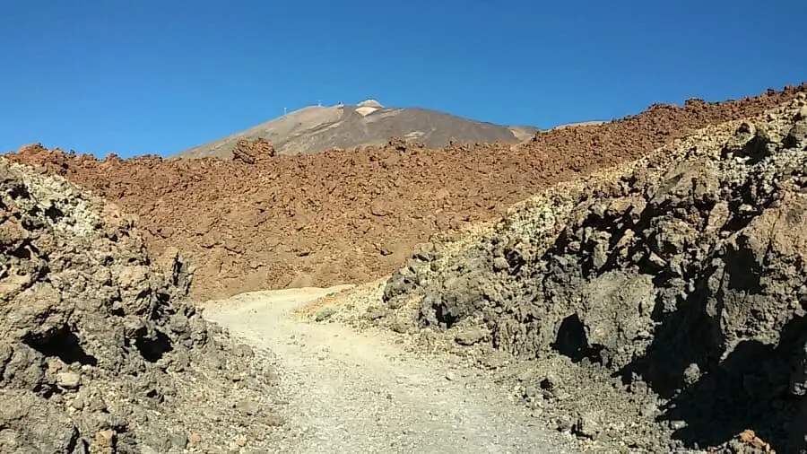
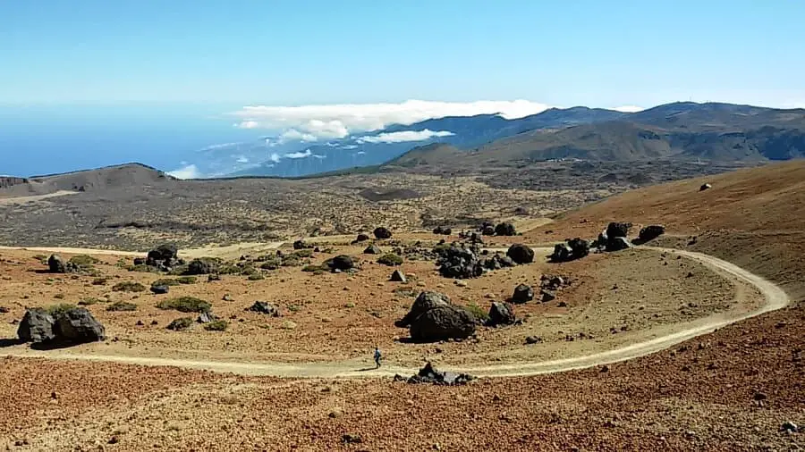
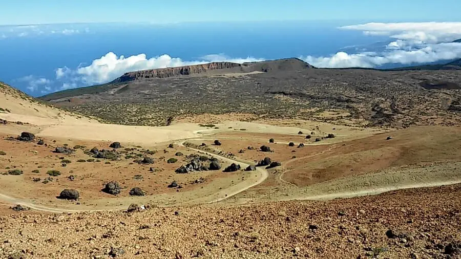
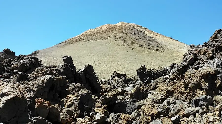
We started at the car park of the TF-21 at kilometre 40.5, where we got the last spot. The path to Montana Blanca is easy and takes about 1:20 hours. Then comes the steep climb to the Teide mountain station. I managed this in 2 hours. The path is not difficult, only the thin air gets to you at some point. You should take breaks in good time and drink enough.
If you like you can visit the Altavista-Hut stay overnight. This is booked about 2 months in advance and currently costs € 21 per person. The
hut offers bunk beds with clean bed linen. There are vending machines at the top with drinks and food (bring change). You can make
the ascent to the summit until 9:00 without a permit. The sunrise on the summit is certainly a special experience, weather permitting.
You have to leave the hut about 1.5 hours before sunrise to cover the 400 metres in altitude to the summit. At the beginning, the path
is still rocky and uneven. A good lamp is a must. You should also pay attention to the weather conditions. If there is a strong wind,
the Teleferico does not run and you have to go all the way back down.
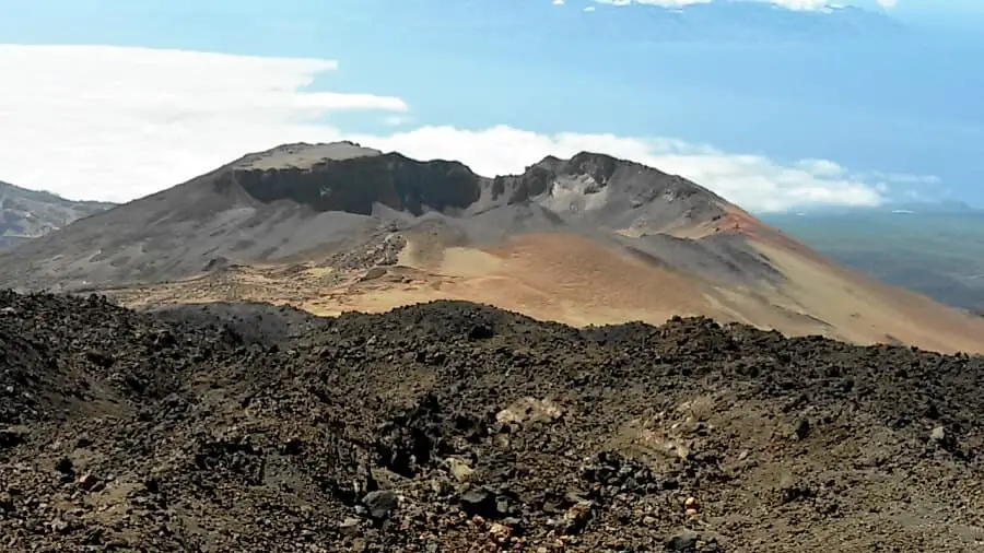
At the top I visited both miradors. The first is on the path and for the second you have to walk an extra 1.5 km. From there you can see Pico Viejo. But I must honestly say that the extra walk is not worth it. At the top station, a fierce wind blows and at some point the exertion at 3500 metres becomes noticeable. Then it's time for the return trip. You can book the ticket (22 €) at the top. I was picked up at the valley station and did not have to walk the 3 km to the car park.
A detailed description of the route and the GPS track can be found in the Hiking Guide Tenerife.
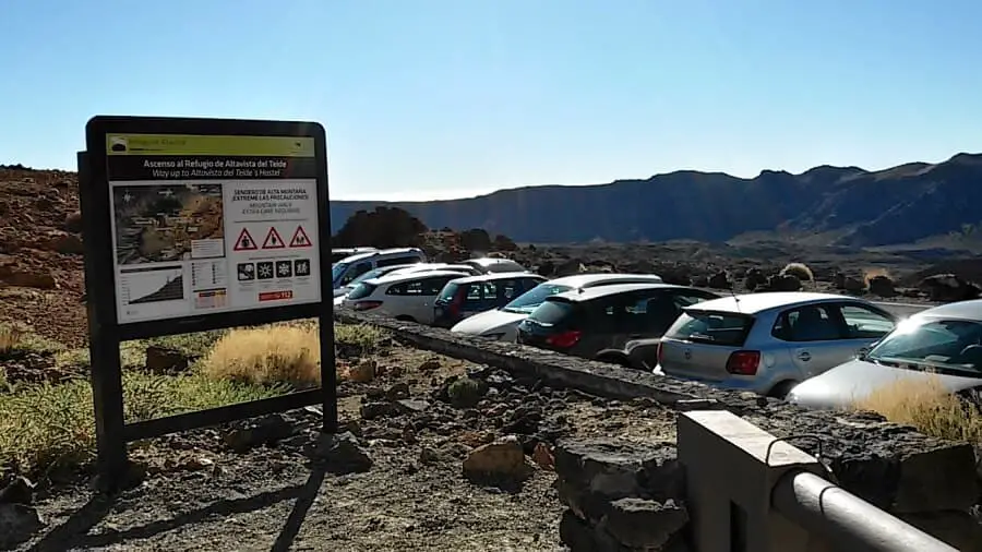
Photo Gallery