


![]()
Difficulty: middle
Fitness: middle
Fear of heights: easy
Surefootedness: middle
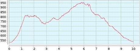
Distance: 9,98 km
Duration: 4:20 h
Heights: ![]()
![]() 534
534
Start/End:
El Palmar


Hike 9: El Palmar/Teno Alto
This hike is recommended as an introduction to the Teno Mountains. Despite the first ascent, it is not very strenuous and offers wonderful views over the Teno plateau, especially in good weather.
We start in El Palmar and walk along the ridge to Teno Alto. In this small village, also called Los Bailaderos, we keep left at the church in the direction of La Mesita and continue hiking along the ridge of Cumbre de Baracan. At the Mirador La Tabaiba, we keep left before the viewpoint and hike back to the Palmar Valley.
You should go on this hike especially when you can hardly see any clouds over the western part of Tenerife in the morning. At noon, the trade wind clouds move into the Cumbre. Therefore, you should start the tour early.
A detailed description of the route and the GPS track can be found in the Hiking Guide Tenerife.
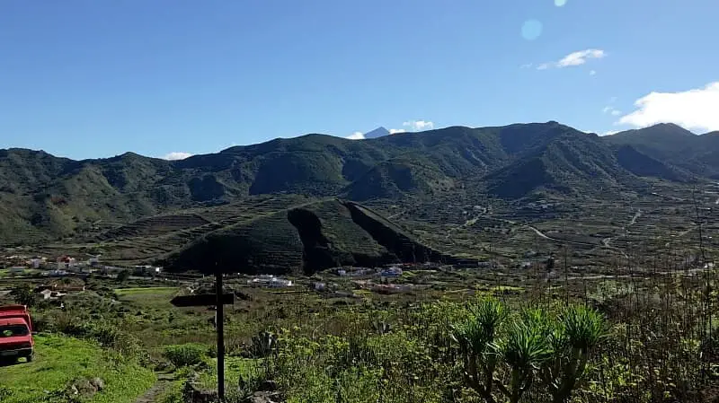
Photo Gallery