


![]()
Difficulty: easy
Fitness: easy
Fear of heights: easy
Surefootedness: easy
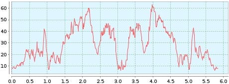
Distance: 5,84 km
Duration: 2:00 h
Heights: ![]()
![]() 164
164
Start/End:
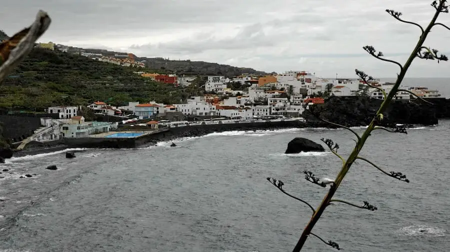
San Juan de la Rambla


Hike 55: Panorama trial at San Juan de la Rambla
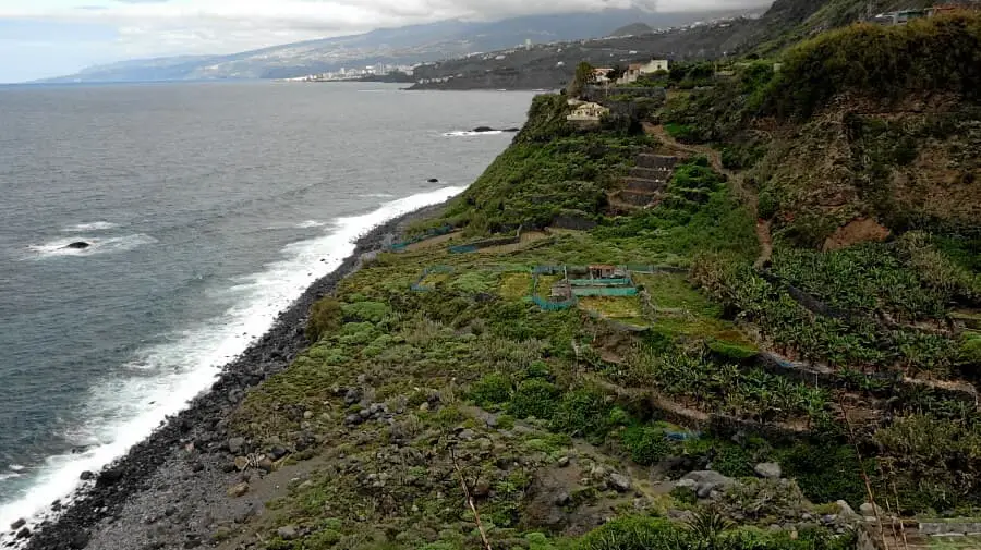
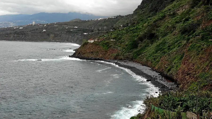
This hike is the continuation of Tour 55, but you cannot continue on Tour 11 because part of the cliff is closed at Playa del Socorro. So you drive to San Juan de la Rambla and then turn right down to Las Aguas. There are some parking spaces there.
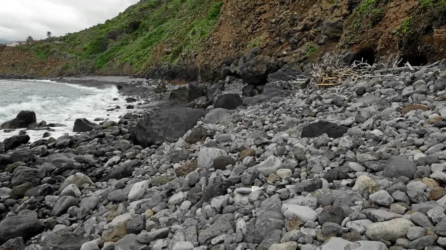
The path leads to the right, always along the coast. The ground is easy at first and then a bit uneven, partly on steep stone steps. So you should not consider these 6 km as a walk. After 3 km, you reach a section of coast with large stones. Here walking is not only difficult, but in my opinion also a bit dangerous. However, there are various rocks where you can sit down and enjoy the surf. The way back is the same. At the starting point there are several restaurants where you can stop for a bite to eat.
A detailed description of the route and the GPS track can be found in the Hiking Guide Tenerife.

Photo Gallery