![]()
Difficulty: middle
Fitness: middle
Fear of heights: middle
Surefootedness: high
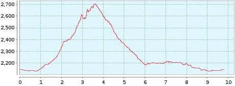
Distance: 9,79 km
Duration: 4:30 h
Heights: ![]()
![]() 650
650
Start/End:
Parador Nacional


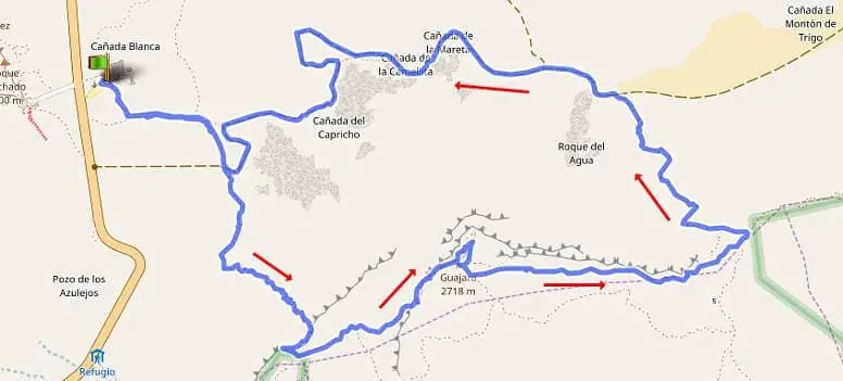
Hike 29: Guajara about Degollada Ucanca
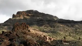
The alternative route to the third highest peak of the Canadas is via the Degollada de Ucanca. In my opinion, it is much safer to take this route on the ascent instead of the descent. After turning right onto the Degollada, you should constantly keep an eye on your GPS. We had a minimal deviation right at the beginning, which then became stronger and stronger on the steep slope. Orientation was extremely difficult because there were cairns everywhere, where others had already gone wrong. Only after we had reached the main path again did we feel up to the climb. Then it even started to be fun. It is not really difficult. There are no exposed parts. Only on some rocks you have to support yourself with your hands.

We did not descend from the summit via the normal route (Tour 17), but took the path to the left over the ridge. This is much shorter. In some places you walk over gravel-like ground. Overall, the path is very safe. After 45 minutes, you reach the descent of the normal route, which you then follow for another hour to the Parador.
I would recommend this route to experienced hikers rather than taking the long normal route in the ascent and descent. Those who are not sure about the steep slope over the Degollada de Unanca should in any case choose tour 17. The route is longer but absolutely safe.
A detailed description of the route and the GPS track can be found in the Hiking Guide Tenerife.
Photo Gallery


