


![]()
Difficulty: easy
Fitness: easy
Fear of heights: easy
Surefootedness: middle
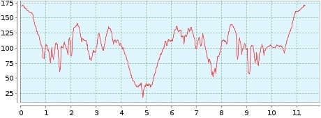
Distance: 11,35 km
Duration: 3:00 h
Heights: ![]()
![]() 445
445
Start/End:
Los Realejos
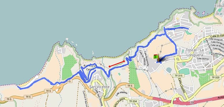

Hike 11: Panorama Trail at Los Realejos
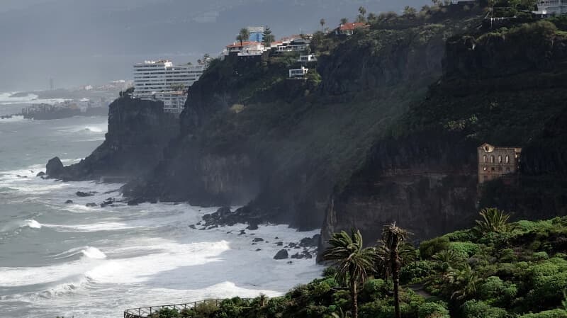
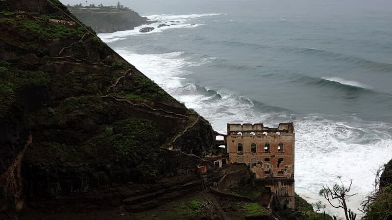
We did this hike out of necessity on a rainy day. Since it revealed surprisingly fantastic views of the north coast around Los Realejos, we did the tour again in better weather.
It can be walked flexibly between the Loro Park in Puerto de la Cruz, Los Realejos and Playa del Socorro. We walked from the hotel in Los Realejos to the playa and back again.
The path offers some climbs with a total of 445 metres in altitude, which have nothing to do with a short walk. Park-like facilities such as the Madre del Agua can also be seen. From Playa del Socorro, the path is unfortunately closed for a longer period of time due to falling rocks. At the Mirador San Pedro you can stop for a bite to eat.
A detailed description of the route and the GPS track can be found in the Hiking Guide Tenerife.
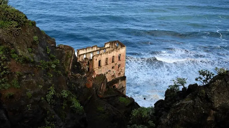
Photo Gallery